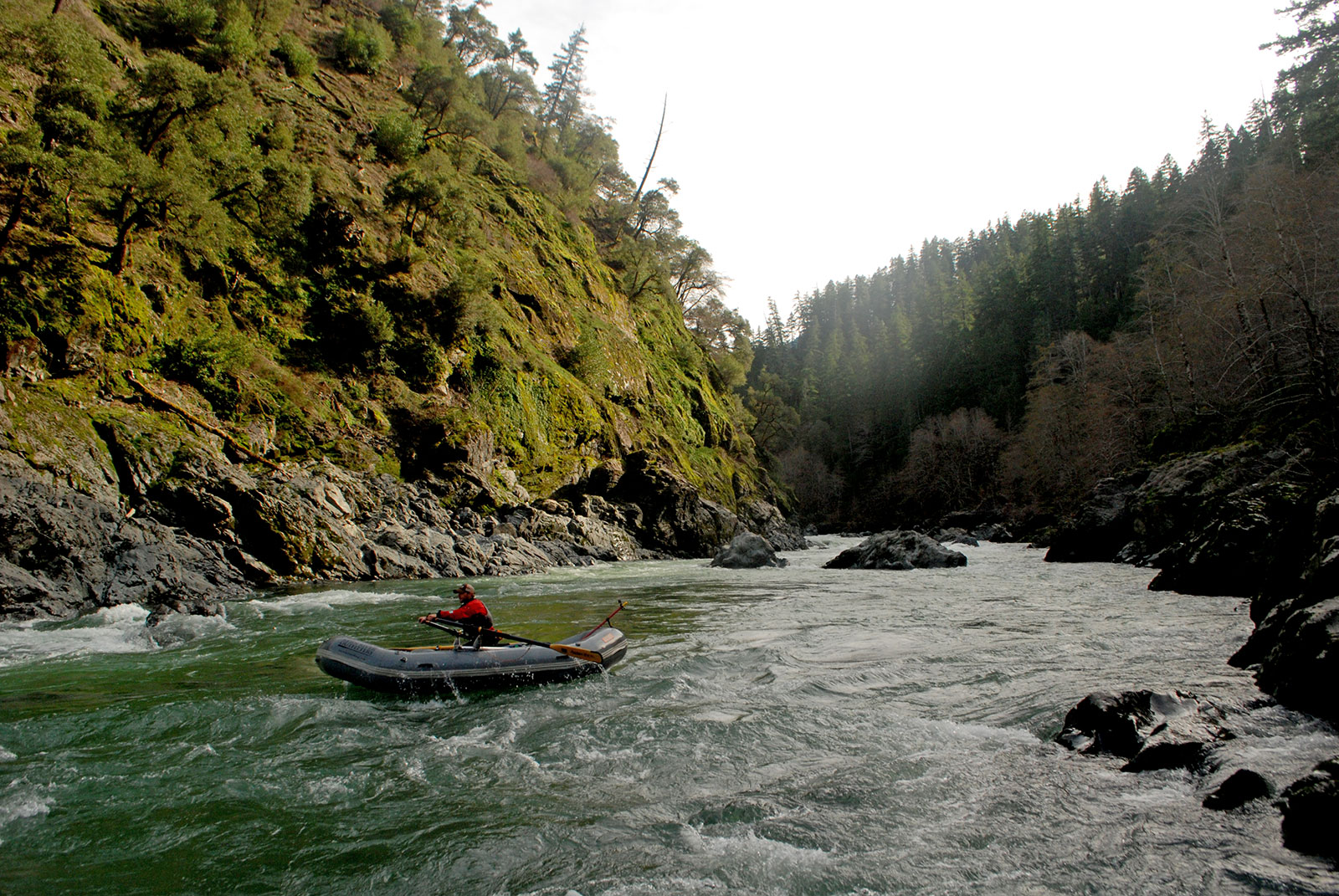
I own and operate Indigo Creek Outfitters, an Ashland-based whitewater rafting company that runs trips on the Rogue and Klamath rivers. Shortly after I moved to Southern Oregon in 2004 I started exploring some of the nearby rivers and absolutely fell in love with the area.
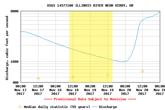
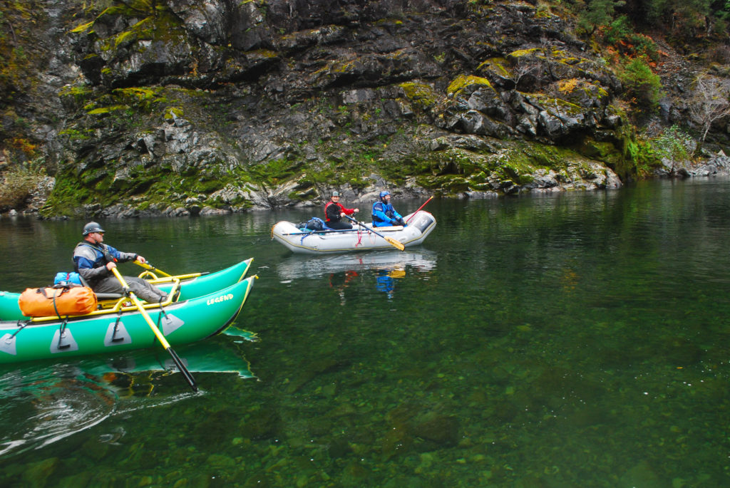
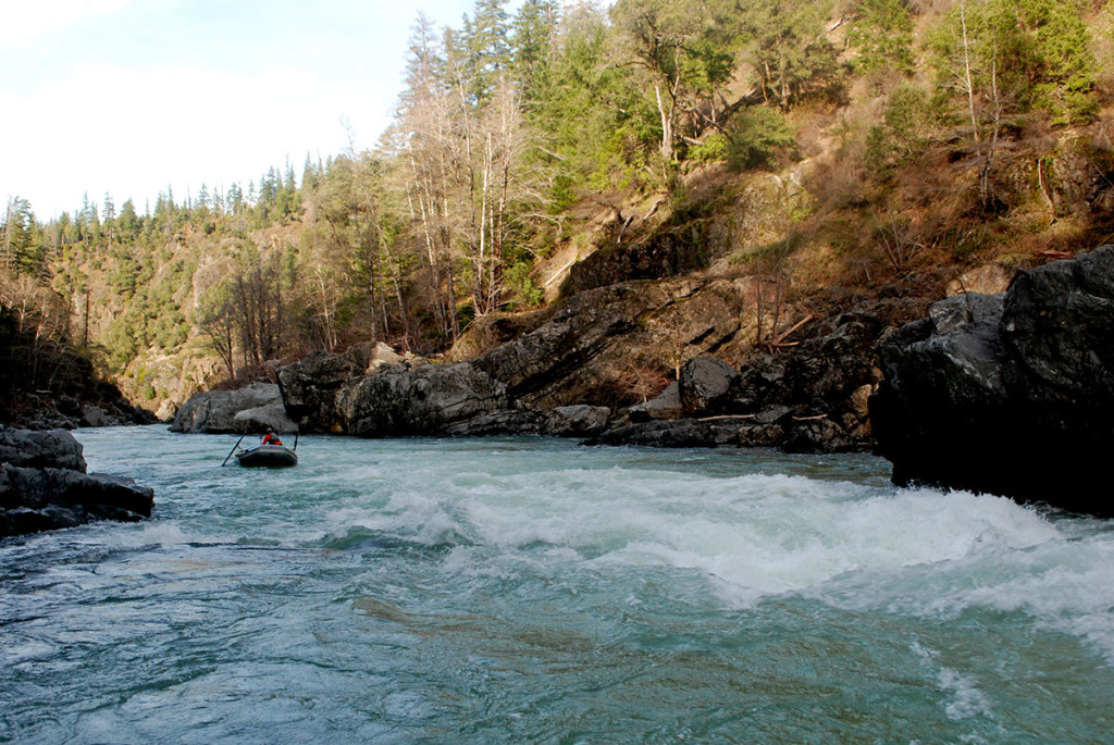
We launched around 10:30 a.m. on Saturday and pushed down to South Bend. Got there around 2:30 p.m. and decided to call it quits for the day. The next morning we were off around 9:30 a.m. Stopped at Waterfall Camp for a break and got to Oak Flat around 3:00 p.m.
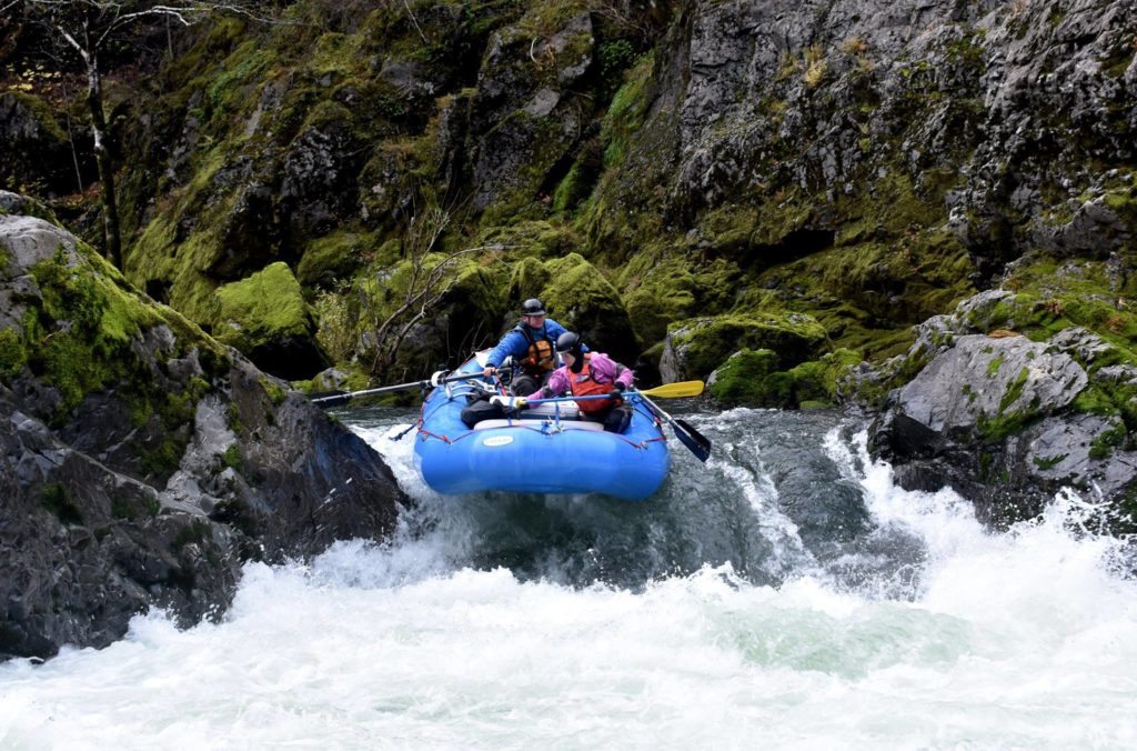
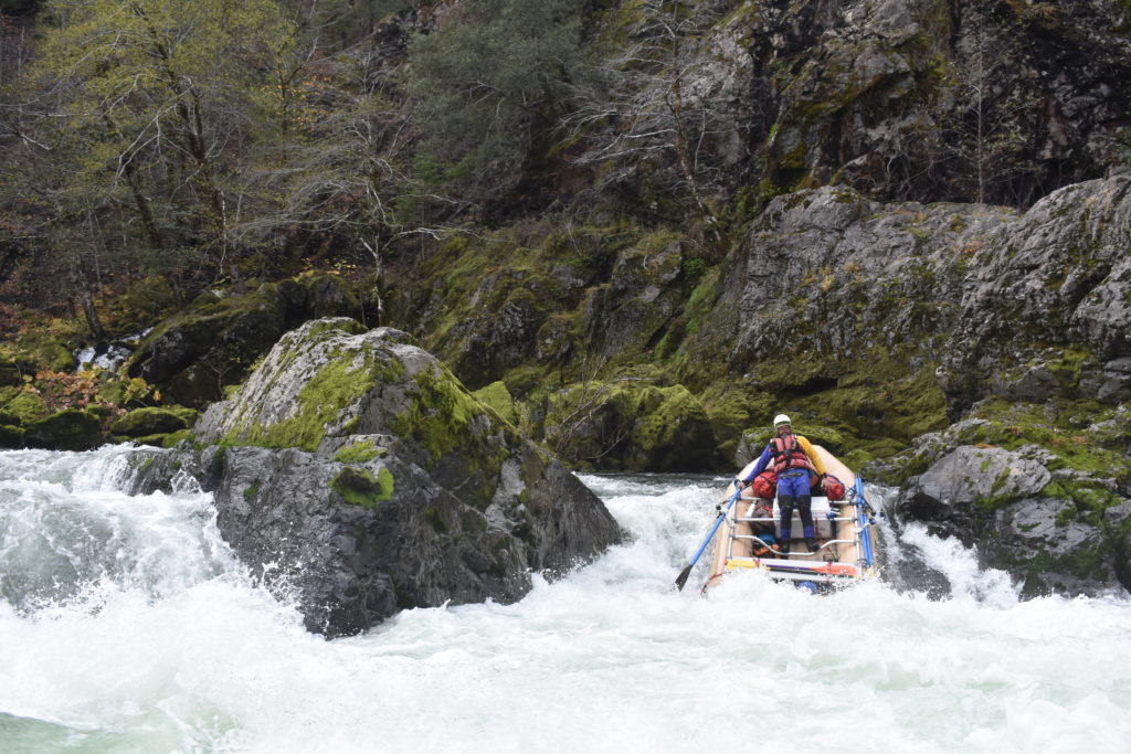
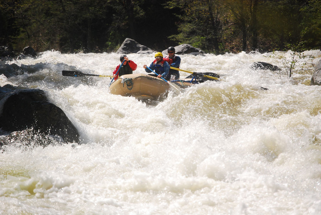
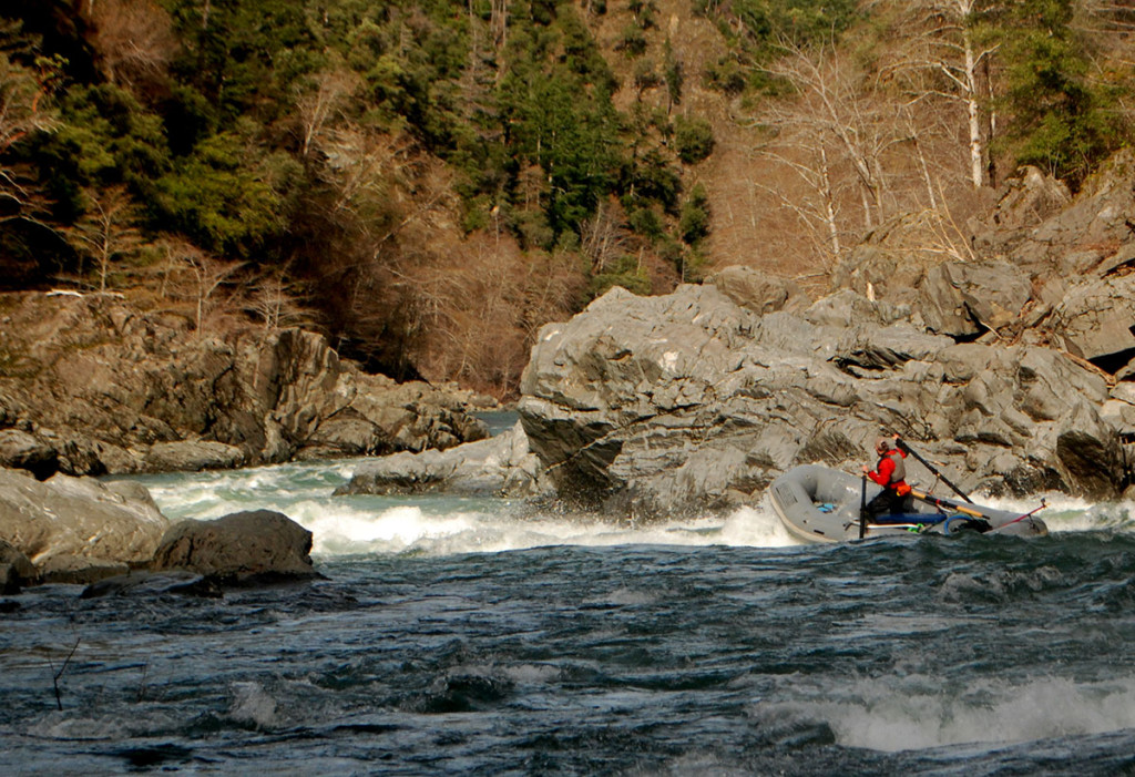
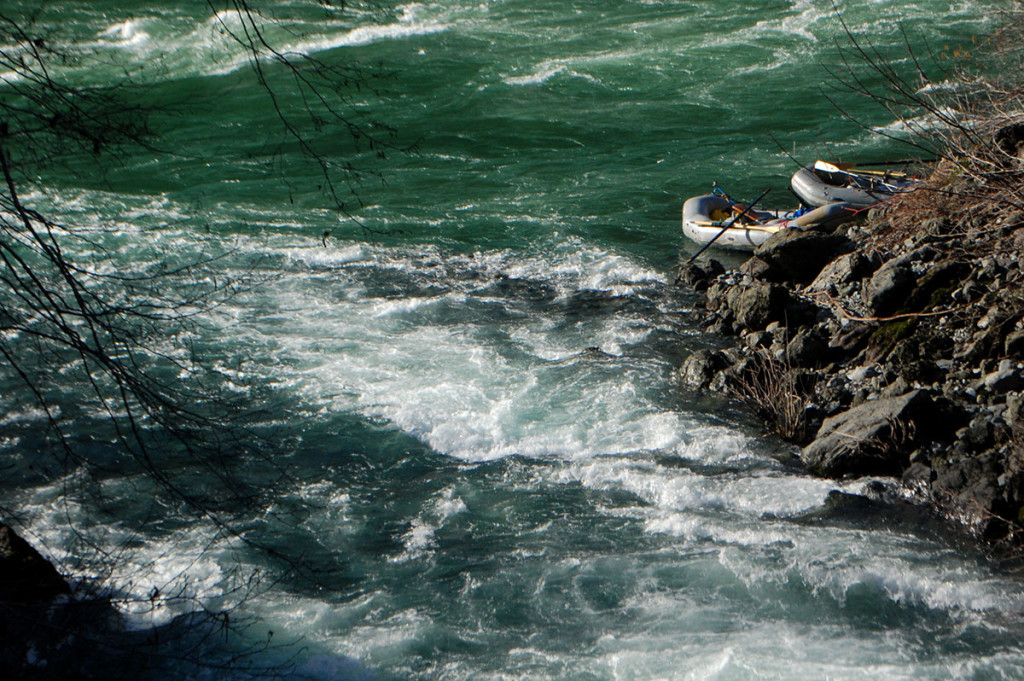
Evidence of the Chetco Bar Fire was visible starting a mile or so above South Bend through Green Wall. There are some big trees that will be making their way downstream, but the only tree we saw in the river and somewhat in play was at Submarine Hole. This log was in the normal right entrance. Fortunately there was enough water to enter left. However, at lower flows this log will be in play until it flushes downstream.
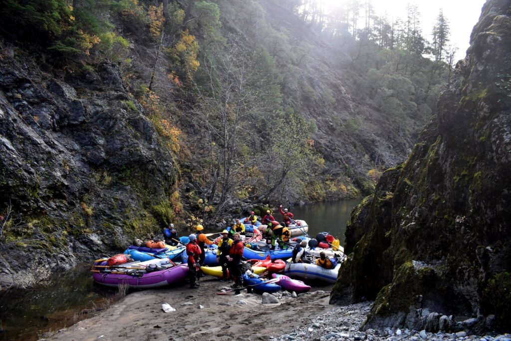
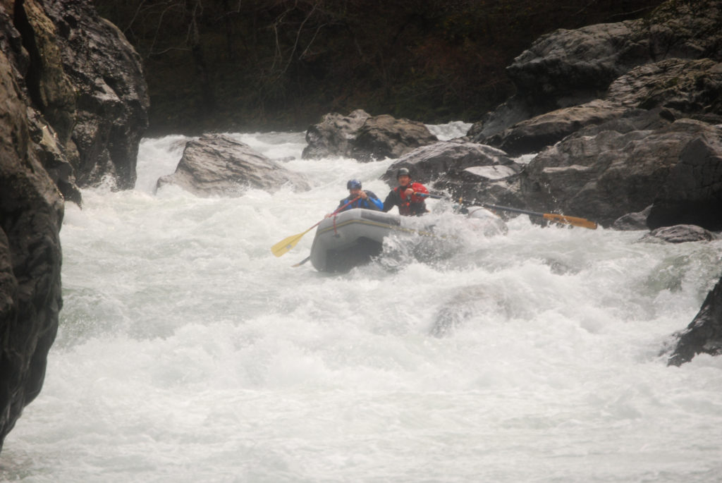
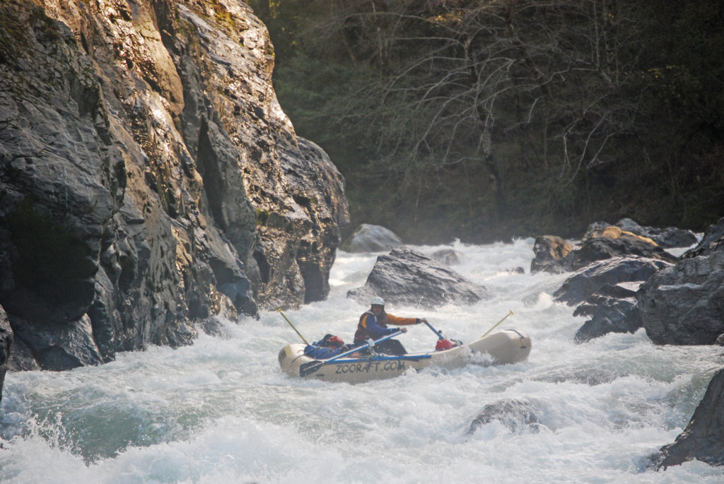
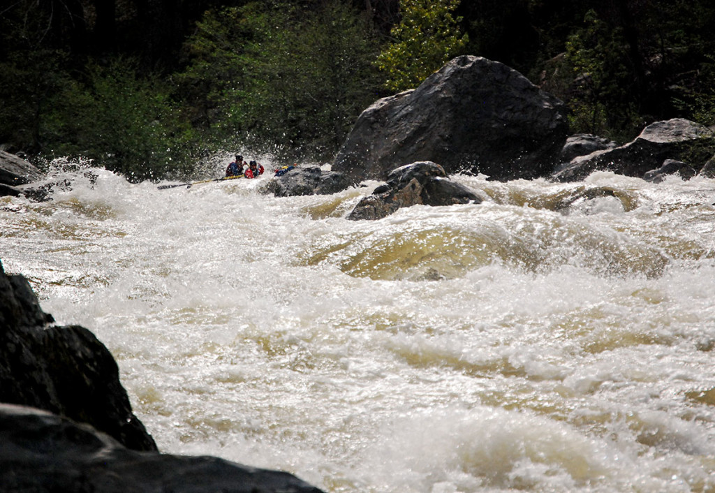
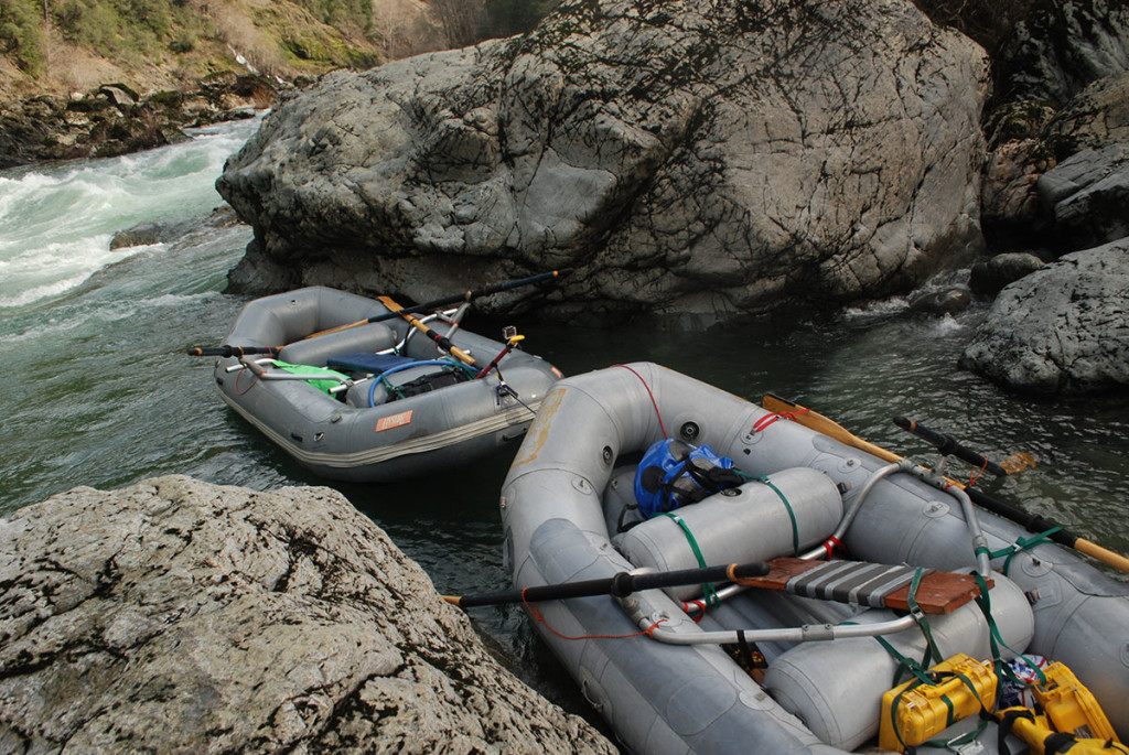
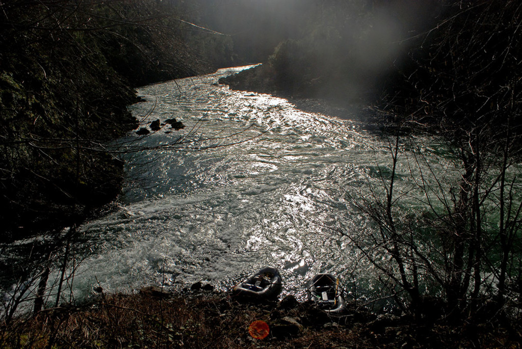
Camp at South Bend on the Illinois. Photo by Bill Klingler.Aaron Babcock in Fawn FallsRyan lines up for Fawn FallsBrian heading into Fawn FallsEvidence of the Chetco Bar Fire at the scout for Green Wall. Photo by Bill Klingler.
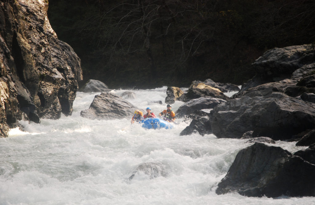
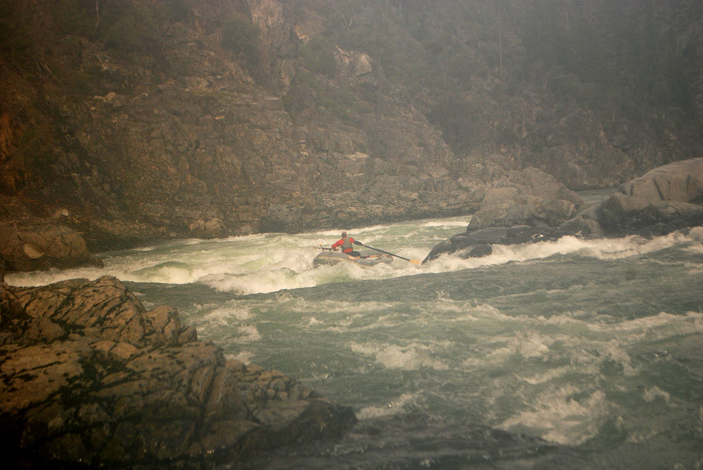
Scouting Green Wall. Photo by Bill Klingler.Aaron Babcock through the bottom of Green Wall. Photo by Bill Klingler.Between Green Wall and Little Green WallInitiating the Pimp SlapExperiencing the Pimp Slap in Little Green WallEnjoying the Pimp SlapSubmarine HoleStopped at Waterfall Camp
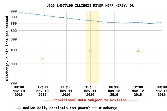
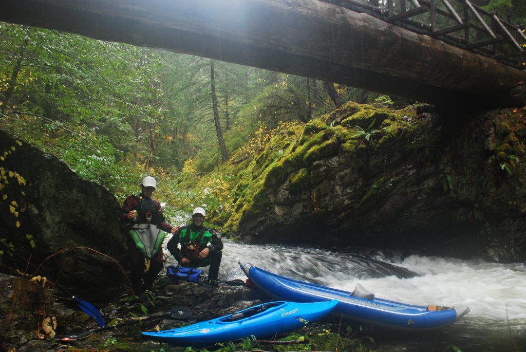
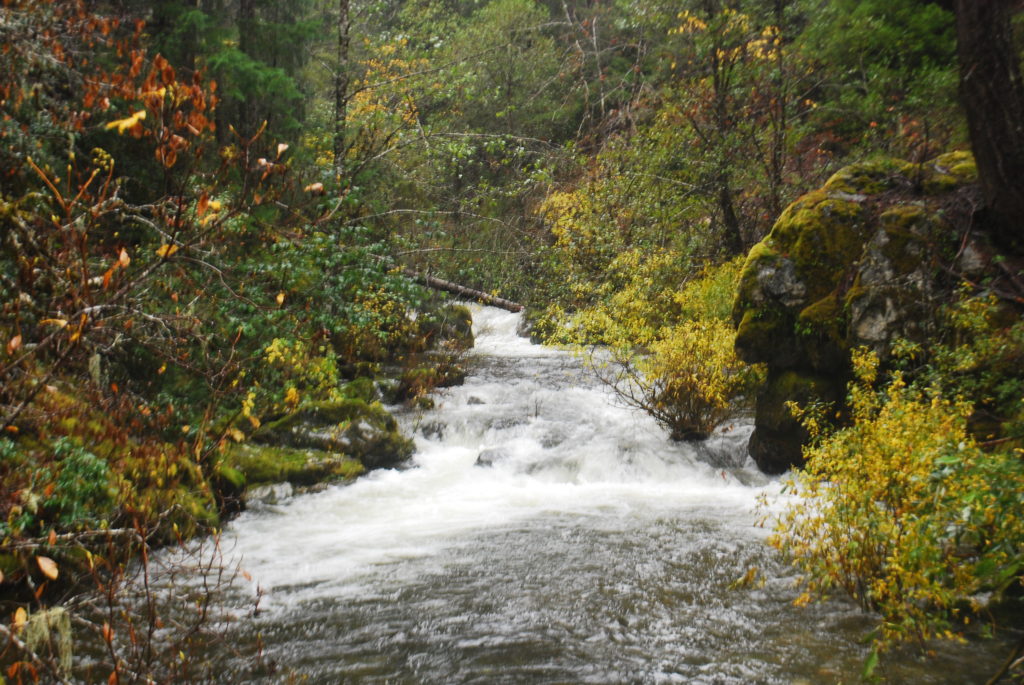
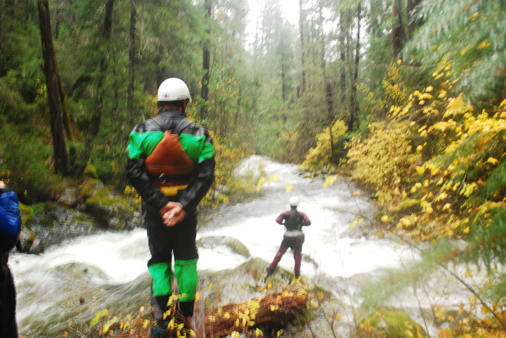
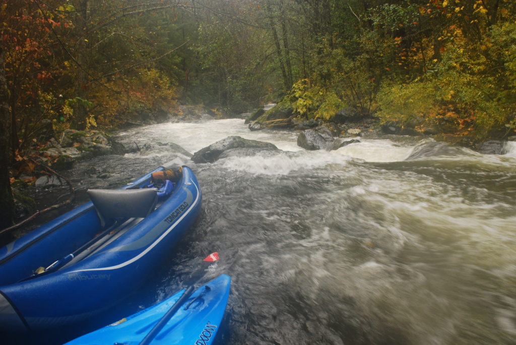
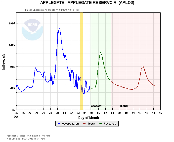
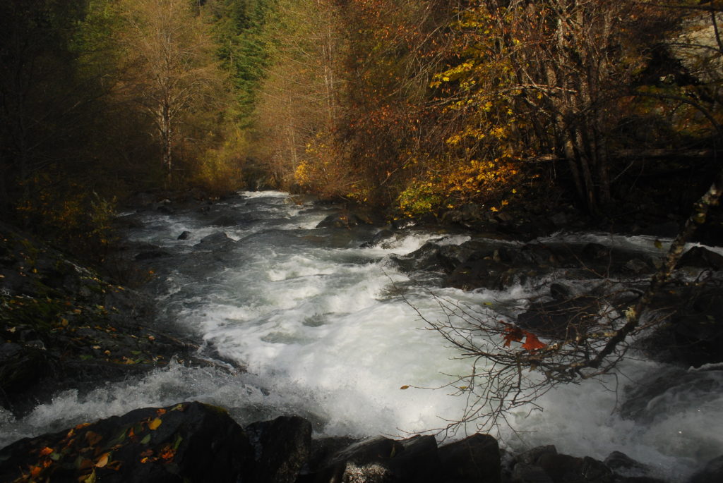
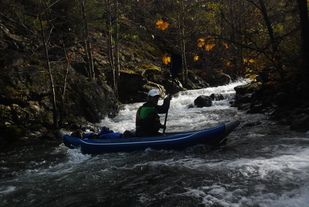
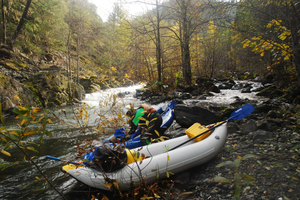
Jackson Creek is a tributary to the South Umpqua and offers a fun and logistically-friendly day adventure. There is no gauge on Jackson Creek, so use the Tiller gauge. On this trip, the water was on its way up and this was certainly a minimum flow for a raft.
There are numerous places you could use as access points. We boated roughly 10 miles in approximately 3 hours. There were logs across the river in numerous places, however at this flow we only had to portage over a log once, and were able to duck under the rest of them.
Lots of mellow Class I & II with beautiful scenery.One of the fun drops on Jackson CreekGlen and TJ in a fun rapid on Jackson Creek, a tributary to the South UmpquaAfter a quick portage we ran this fun drop.
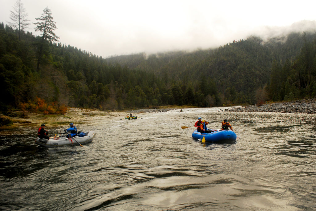
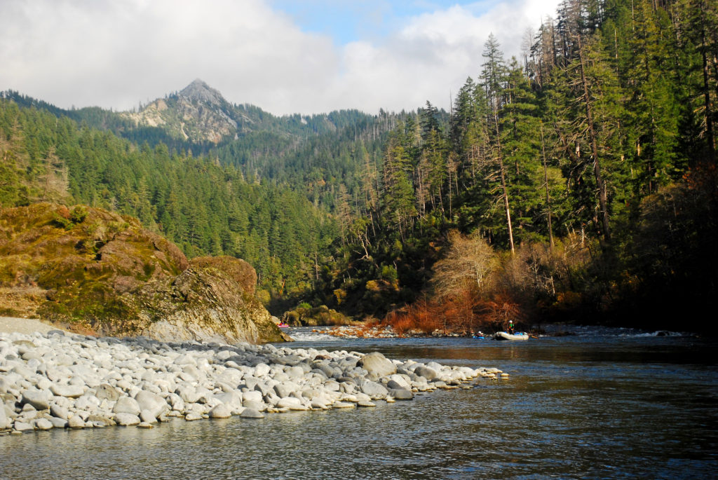
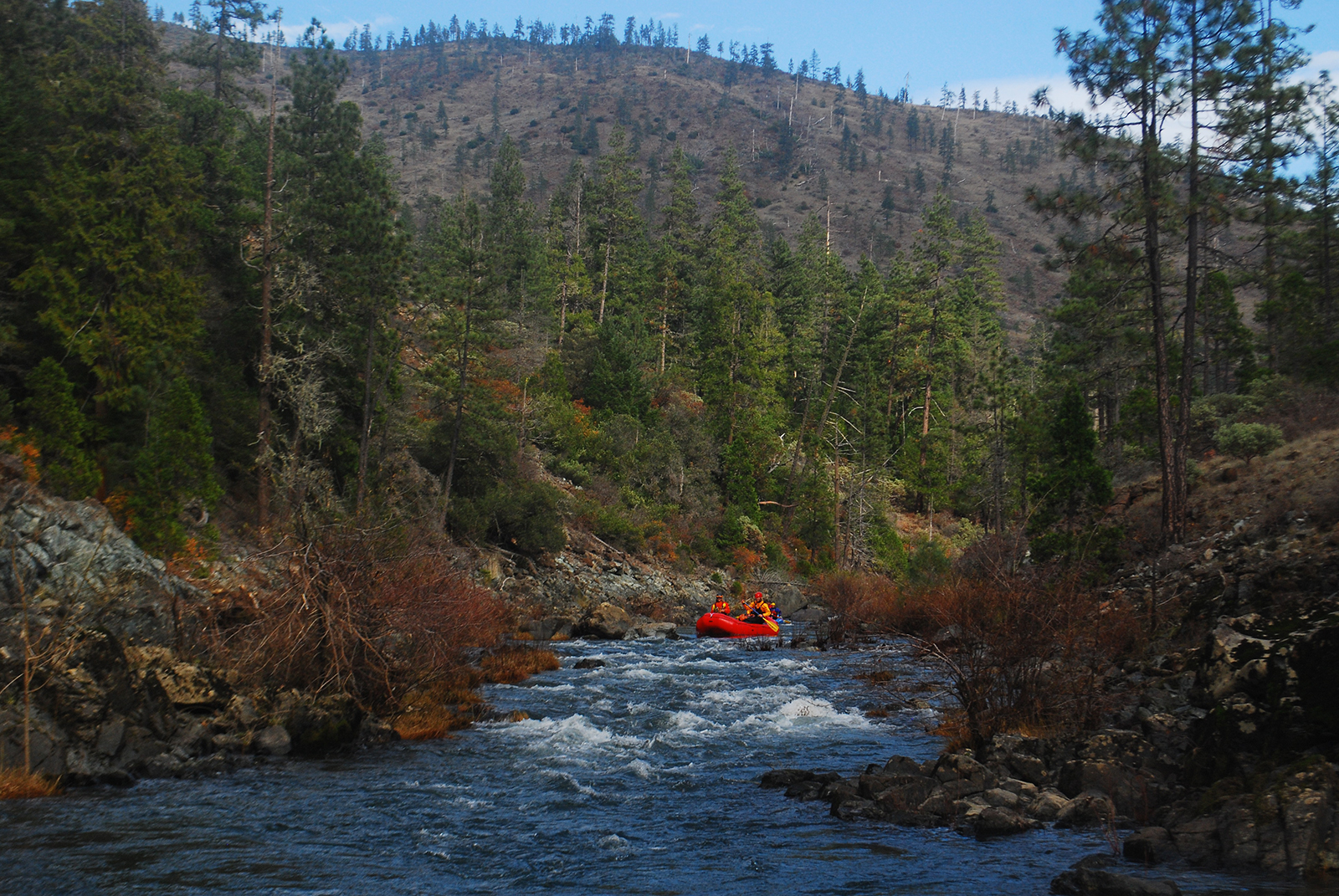
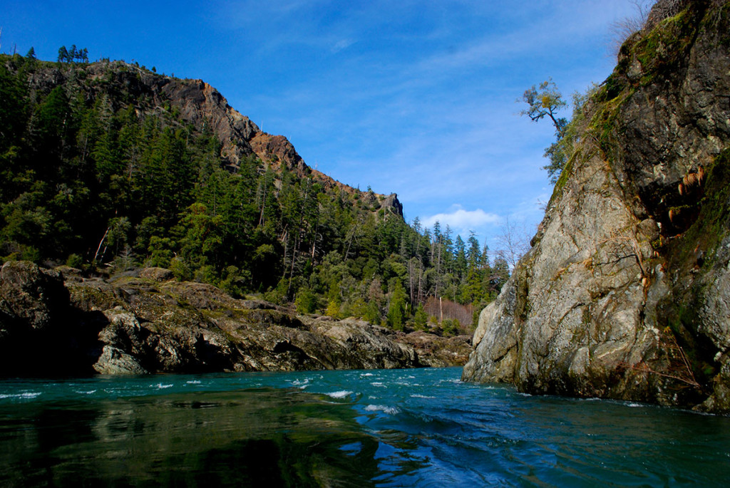
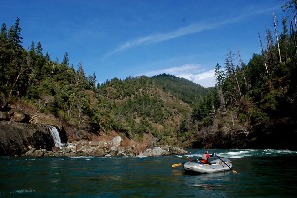
From a photography perspective this was about the most perfect trip you could have on the Illinois. It had not rained in roughly a week and the water was crystal clear. The sun came out multiple times throughout the trip. The flow was on the low side but with how saturated the area had become (we had one of the the wettest Octobers on record) the creeks were still pumping in lots of water.
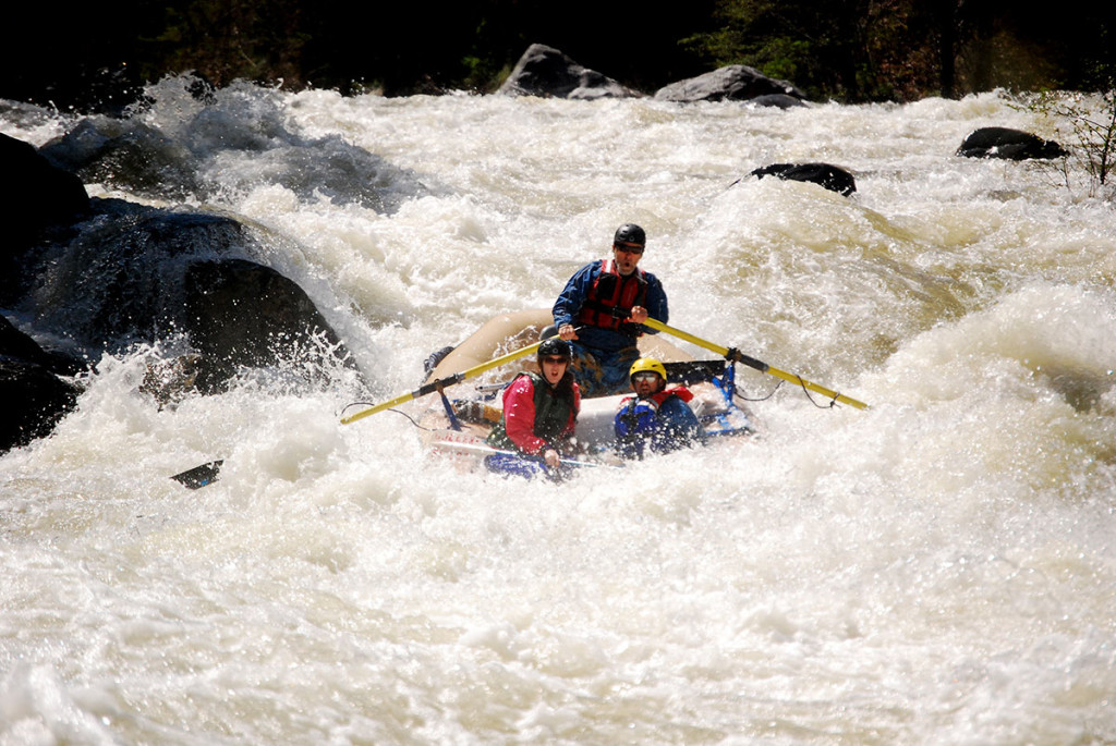
We left Selma around 8:00 a.m. on Saturday morning. Arrived at South Bend at 3:30 p.m. Left South Bend the next morning at 9:30 a.m. and found ourselves at Oak Flat right at 3:00 p.m. The icing on the cake was that Bear Camp was still open for the shuttle drive back.
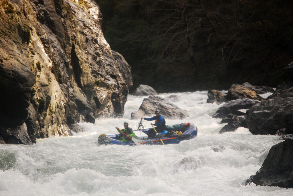
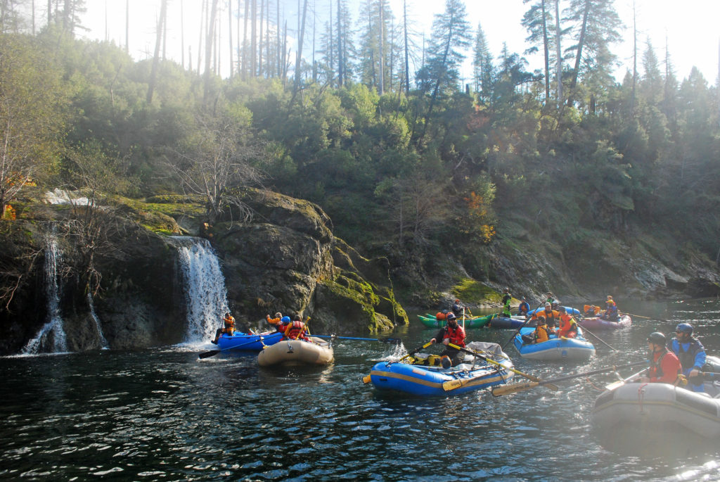
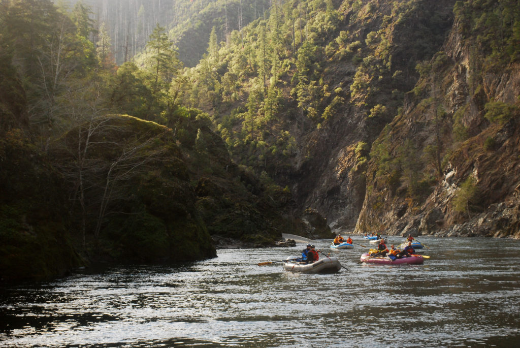
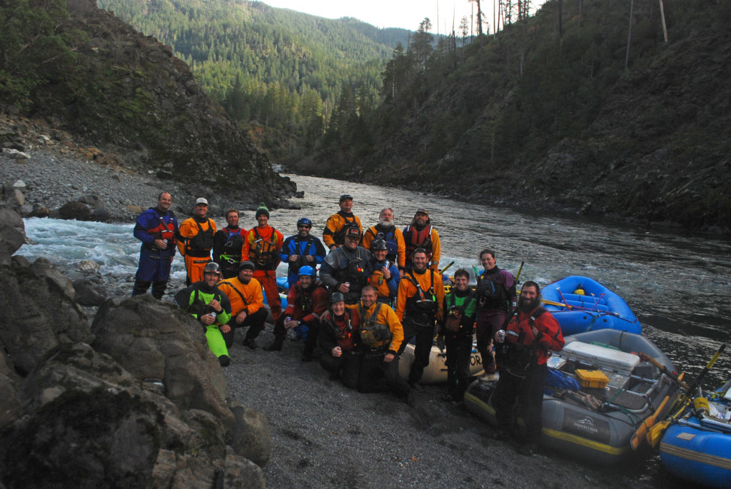
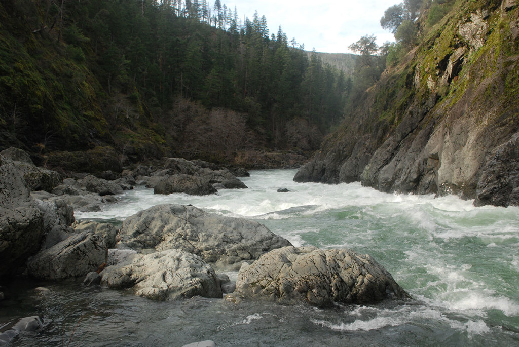
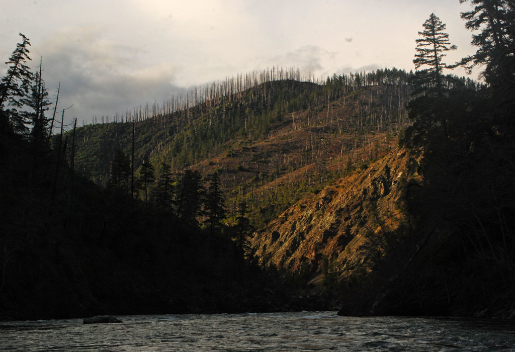
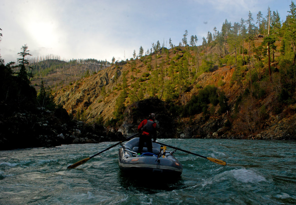
Beautiful water on the Illinois River.Frank Debaugh looking downstream above Pine Creek Rapid.Looking upstream just above Pine Creek Rapid.Looking upstream from Klondike Creek.Great weather on the Illinois River. Just above Yukon Bar.David, Thomas, and Michael punching through a hole on the Illinois River.Brian and John entering the bottom drop at Green Wall.Jake Wallace in Green Wall.Frank Debaugh entering Green Wall.Thomas Hood in Green Wall.Sami toward the bottom of Green Wall.Aaron Babcock and Kelsey in the midst of Green Wall.Adam Spencer and crew through Green Wall.Ryan Arsenault in Green Wall, Illinois River.Sunshine and waterfalls on the Illinois River.The lower canyon of the Illinois River is stunning in the sun.Group shot at Indigo Creek.
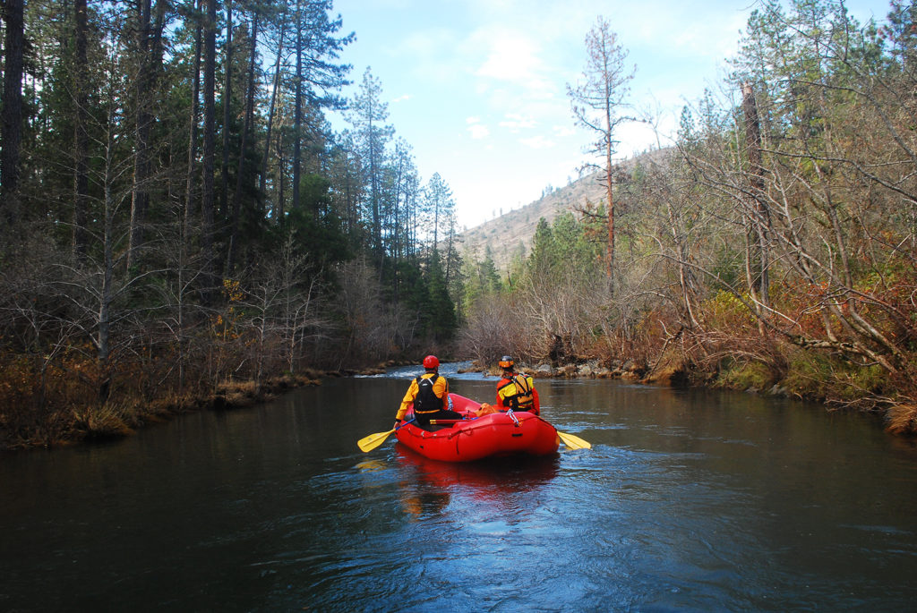
Deer Creek is a large tributary to the Illinois River that flows through the town of Selma, Oregon. It is accessible off of Hogue Drive in Selma. Running Deer Creek into the Illinois is a nice alternative to launching from Eight Dollar Bridge (on the Illinois), as the run from Eight Dollar Bridge to the mouth of the Deer Creek is unremarkable. Additionally, running Deer Creek will shorten your shuttle substantially if you are simply doing a day trip and taking out above Miami Bar on the Illinois.
Launching from Hogue Drive in Selma, Oregon.
Most report running Deer Creek when the Illinois is flowing over 2500 cfs, however, as we found on this short trip, it can be run in small rafts when the Illinois is as low as 750 cfs. Obviously, flows on individual creeks within the Illinois drainage can be hit or miss depending on where rain is falling. The good news is that you can simply drive over the creek and assess the flow for yourself.
Launching from Hogue Drive, the creek is very mellow with current but no rapids. As the creek approaches its confluence with the Illinois, there are a handful of technical Class II rapids that probably get more interesting with higher flows.
Scenery is outstanding as you float along Eight Dollar Mountain.
Reaching the Illinois, you’ll find a handful of fun rapids, especially just prior to reaching Six Mile Creek. Six Mile Creek is the first road access you’ll hit and makes for an easy take out and shuttle. One could continue downstream to McCaleb Ranch, however that will involve a few miles of very little whitewater and a probable portage at Big Falls.
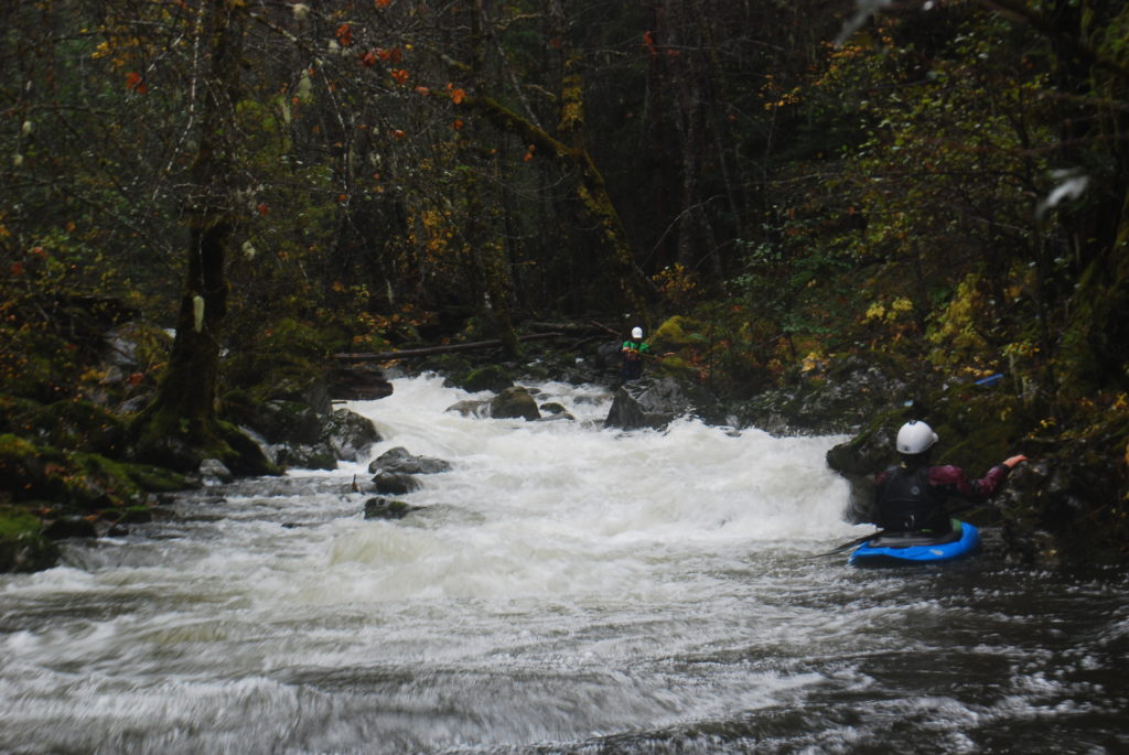
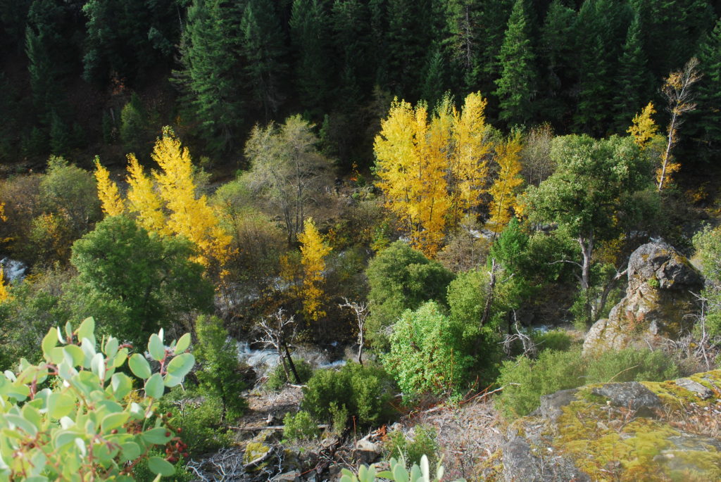
The Butte Fork of the Applegate is a tributary to the Upper Applegate in way Northern California. It’s within the Red Butte Wilderness Area and requires a short downhill hike to access the creek. The take-out is at the confluence with the Upper Applegate, which has a road following it. The short run starts off pretty mellow (class II / III) but the character of the creek changes dramatically in its final mile descent into the Applegate. The run out is very continuous with the random log thrown in for good measure. On this particular trip, the run out was huge as the creek had gotten quite high and the last mile or so was very continuous Class IV and V. After walking for a bit we left some boats and gear behind and headed back to the truck. A few days later, Frank and I came back after flows had dropped.
When we first launched, the creek felt a bit low. As it continued to rain, the water steadily rose.
Sami and Frank at the put in for the Butte Fork of the Applegate
To get to this bridge, start at the Shoofly Trailhead. Follow the trail down to the Butte Fork and, when you get near the creek, look for a subtle split in the trail. Turn left and follow the Butte Fork Trail #957. A quarter mile later you’ll cross the Butte Fork and find easy river access on the right.
Note: The trails in this area have been maintained by the Siskiyou Mountain Club. Thank you SMC!
The Butte Fork of the Applegate
The photo above shows the very last rapids we ran prior to our first portage.
Horse Creek enters on the right.
Below Horse Creek, the creek steepens significantly. The rapid at the confluence of Horse Creek and Butte Fork was our first portage. From there, we consistently portaged or ran portions of rapids. The photo above shows the first rapid we portaged, with Horse Creek entering on the right..
The Butte Fork of the Applegate
Just below Horse Creek – this rapid looked like fun, but the bottom drop leaving the photo landed on a couple rocks. With more water it would probably have been good to go.
Sami at the bottom of a smaller drop on the Butte Fork of the ApplegateAaron Babcock scoping out a nice drop
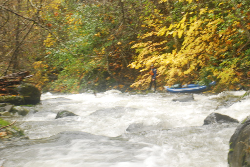
After the rapid above, the gradient continued to pick up and flows increased and we called it quits, hiking out on river-right.
Frank and I returned a few days later and floated out at a much lower flow:
Looking down at the Butte Fork while hiking back in.A lot less water…Nice Fall colors on the Butte ForkFrank is excited to float rather than hike.Some of the last rapids on the Butte ForkJust above the take out on the Butte Fork
If I ever run the Butte Fork again, I would like to see a flow slightly higher than what we saw on our boat retrieval day.
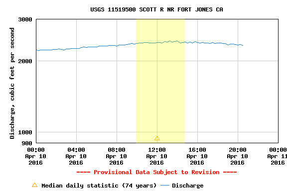
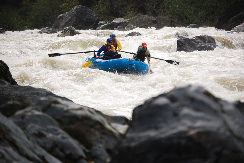
Northern California’s Scott River has had a rough couple years. Two years of brutal drought was finally obliterated by snow-capped mountains in 2016.
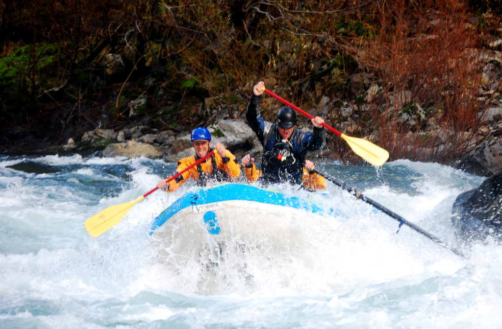
Flows bumped up to 2400 CFS for the day. Overall a great flow and some cheats develop that make things a bit easier. At White House you can run left or right of the large hole and Schuler’s has a cheat down river right and through a tight slot way right to exit the first part of the rapid.
We launched at Indian Scotty Campground and soon stopped to look at Tombstone. The center line looked huge and all three boats opted to run left.
John Fields runs left at Tombstone, Scott River, California.
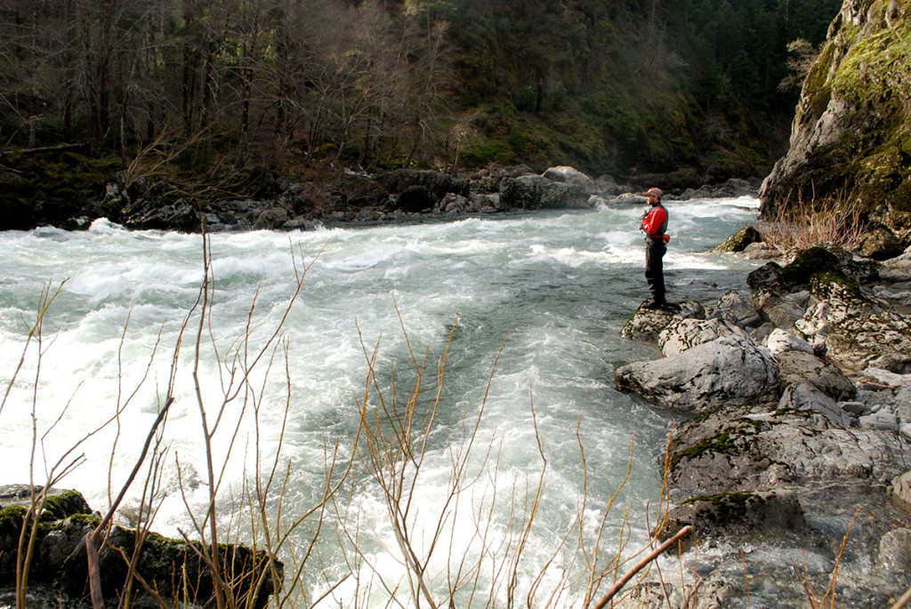
Shortly downstream we pulled over to look at White House.
Tim Sorby dropping into the right side of White House, Scott River, California.Tim Sorby and crew get buried at White House, Scott River, California.All smiles at the bottom of White House, Scott River, California.John Fields lining up for the right-side run at White House, Scott River, CaliforniaThrough the big hole at White House, Scott River, California.
Next up was Tompkins Creek, which we had scouted during the shuttle drive. Shortly after Tompkins we pulled over for a lunch break on river-left.
We scouted from the river-right bank at Schuler Gulch Rapid. A cheat line down the right eliminated the main entry rapid. After that it was a maze of boulders and large holes to avoid.
John Fields exiting the entry to Schuler Gulch Rapid, Scott River, California“Hey diddle-diddle, straight down the middle…”Tim Sorby entering the final section of Schuler Gulch Rapid, Scott River, California.
After Schuler Gulch, the river eases up considerably. Our take out was a mile or two upstream of Scott Bar on river-right, shortly downstream of a bridge over the Scott River.
Skip was making the move from Bozeman to the Kern and was coming through Ashland. I was working on Thursday and busy on Saturday. But the Illinois was at a perfect flow and our friends were doing a two-day launching on Friday. What better time to try to squeeze in a one-day trip, right?
9:45 a.m. – push off from Miami Bar
11:15 – pass Pine Flat
12:30 – stop for a quick bite at South Bend
1:00 – scout Green Wall
2:00 – pass Collier Creek
3:55 – arrive at Oak Flat
Video from Skip’s boat of Green Wall and Little Green Wall:
Photos by Will Volpert:
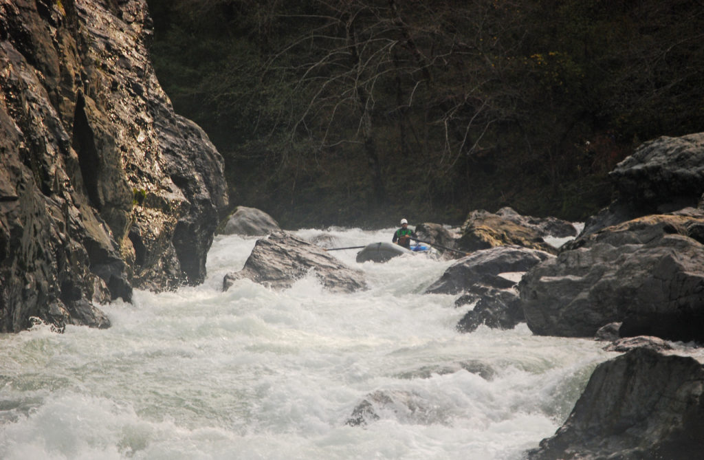
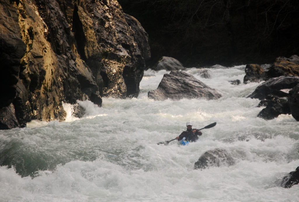
York CreekScouting the entrance to Green WallScouting Green WallGreen WallSkip runs a rapid in the gorgeAnother rapid in the gorgeSubmarine HoleFloating by Collier CreekLower canyon sceneryConfluence of Silver Creek and the IllinoisSilver Creek entering the IllinoisLower canyon sceneryHalf mile upstream of Indigo Creek
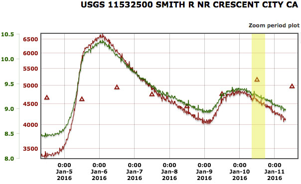
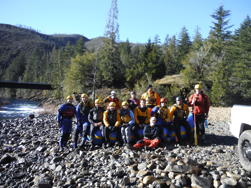
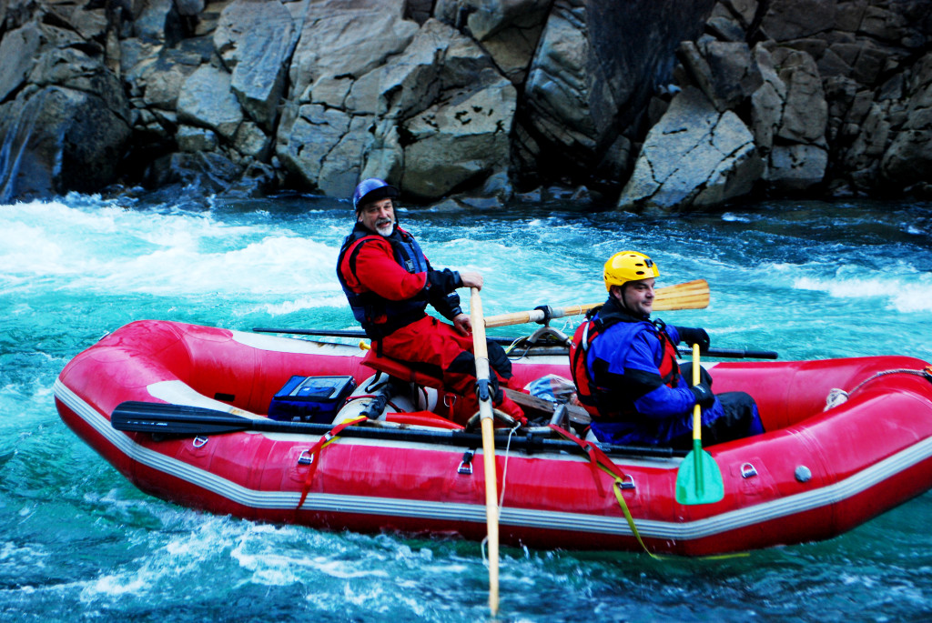
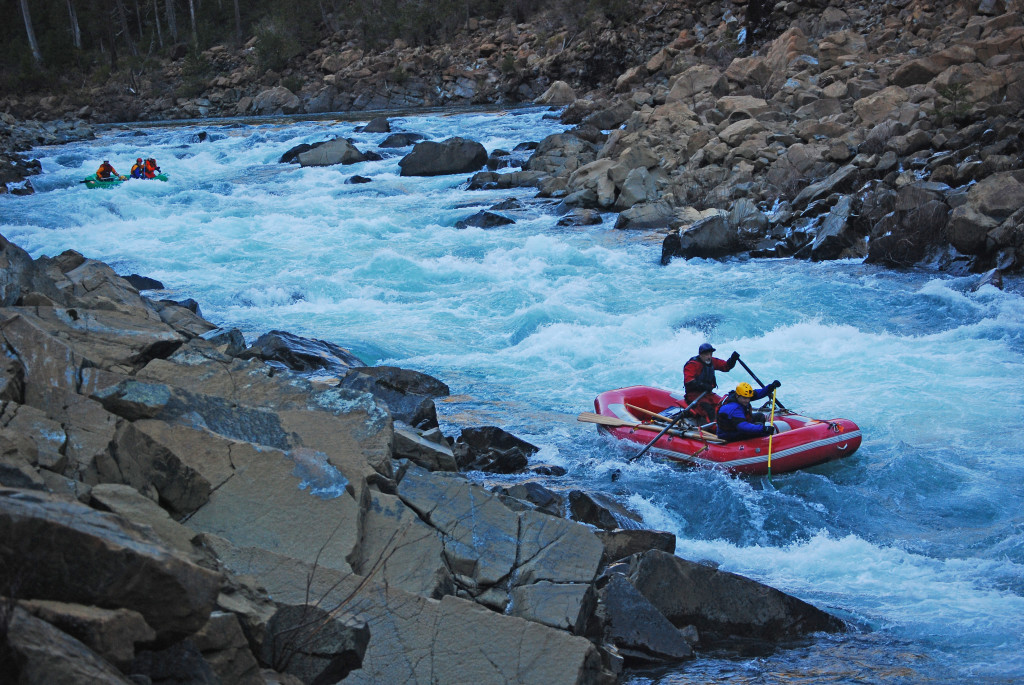
A cool but dry winter day on the North Fork of the Smith began at 9:00 a.m. in Gasquet, California. Flow was lowish but the clear skies and sun made for an enjoyable day. We were off the river and back on the road around 4:30 p.m. The group consisted mainly of Eureka / Arcata folks. Gabe Howe (Siskiyou Mountain Club) and I traveled from Ashland and shared a boat with John Bartosz. Another fun day on the NF.
Group photo at the NF Smith put-in. Photo courtesy of Mark Barsonti.Mark Barsonti and crew entering Scout Rapid on the North Fork SmithMark Lindley and Steve at the bottom of Scout Rapid on the North Fork Smith.Eddied out on the North Fork of the Smith River, California.Mark Lindley at the bottom of Double-Double Rapid.Bill Thorpe and crew running Double-Double on the NF Smith River.
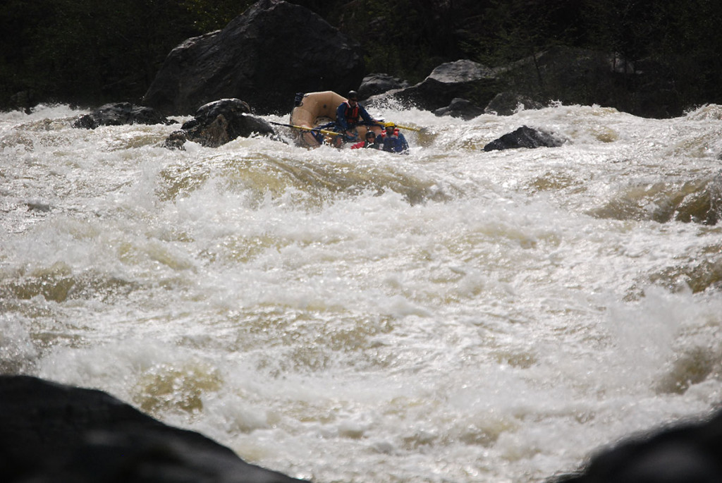
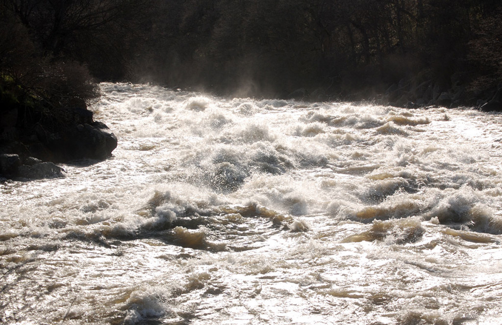
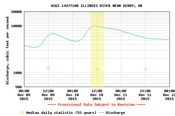
The highest I had seen the Illinois prior to this trip was about 4700 CFS in Kerby. I had chatted with Aaron Babcock in the past year about wanting to see it at higher flows and when the flows were projected to spike, Aaron called and asked if I was still game. Nate Wilson joined too and the three of us met at Ray’s in Selma at 8:00 a.m.
On this trip the river peaked at exactly 10,000 CFS. My goal was to get an idea for what it would be like to bring a raft in at this flow. My impression now is that I would not want to run it at this flow in a raft, but regardless I’ve made some notes about some of the places I think would be problematic for rafts.
Having never been in a Creature Craft I was a little apprehensive but at the same time I’ve seen plenty of videos of folks with seemingly no skill move these things down chaotic rivers so my thought was “if they can I can” and that proved true on this trip. The Creature Craft itself felt awkward to me with tiny oars and a tendency to rock side to side but I also would not have been on the river if not for this boat.
The Illinois at 10k trip notes:
• We launched at McCaleb Ranch. From McCaleb to Miami Bar there was only one stand out rapid with a large wave/hole in the center, a cliff on the left, and an easy cheat on the right. The rapid was within half a mile of McCaleb Ranch. At this flow, it is faster to float the river from McCaleb Ranch to Miami Bar than drive to Miami Bar.
• Below Miami Bar the first significant action occurred at Panther Creek. The boulder field on river left was underwater and you can actually cheat left around the left turn. Then move right. The last section of Labrador Creek is huge with irregular waves that could easily cause chaos in a raft and current flows quickly into Nome Creek rapids. It would be a roll of the dice to keep a raft upright in Labrador Creek.
• Nome Creek – the river bends right and you should stick to the inside bend. There are large reflection waves off the wall on the left at the bottom of the rapid.
• Above BFR – large waves but we cheated right. BFR was no big deal to the right.
• Rapid below BFR – we entered left of center and moved right. Some large holes to look out for but would not be terrible in a raft.
• York Creek – cheated way right against the bank. No problem.
• Upper and Lower Clear Creek – would be a very difficult rapid in a raft. At Upper Clear Creek you’ll want to go way right to avoid chaos near the wall on river left. However, at Lower Clear Creek you would want to be way left. Between the two is a string of huge lateral waves pushing left to right, with one very large hole. I couldn’t tell if the huge hole extended all the way to the left bank. If it did, it would effectively close off a left sneak. If it didn’t, you would want to take a raft way left, which would be a challenging move against the laterals. Starting the move right-to-left towards the bottom of the wave train (at the top of the left turn to Lower Clear Creek) is probably too late to get left.
• Pine Creek (Boat Eater) – you shouldn’t have a problem here left of center.
• Klondike Creek – the river was actually flowing over the gravel bar immediately across from the mouth of the creek. I cheated way right and the cut the corner but there really wasn’t much there. From there to South Bend the water was moving but it’s all easy read-and-run. It would be squirrely in a raft but shouldn’t be problematic.
• Prelude / Fawn Falls – the large boulders at the bottom were underwater and a large hole developed off the cliff on the left to the center of the river. Cheat right. I think in a raft you could cheat right against the right bank. There were some large waves right of center.
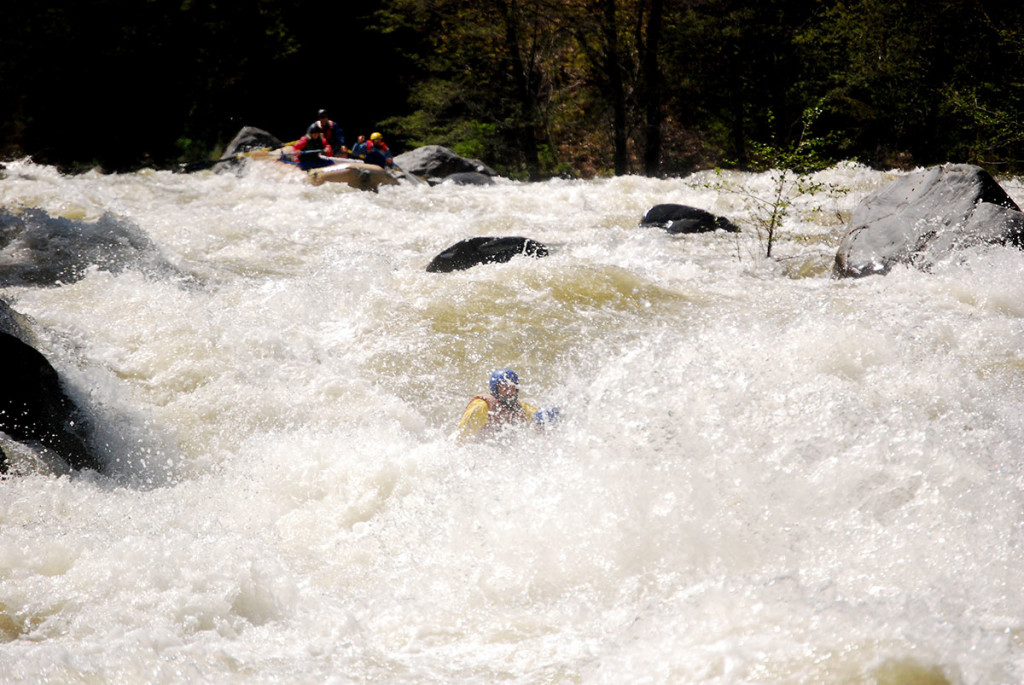
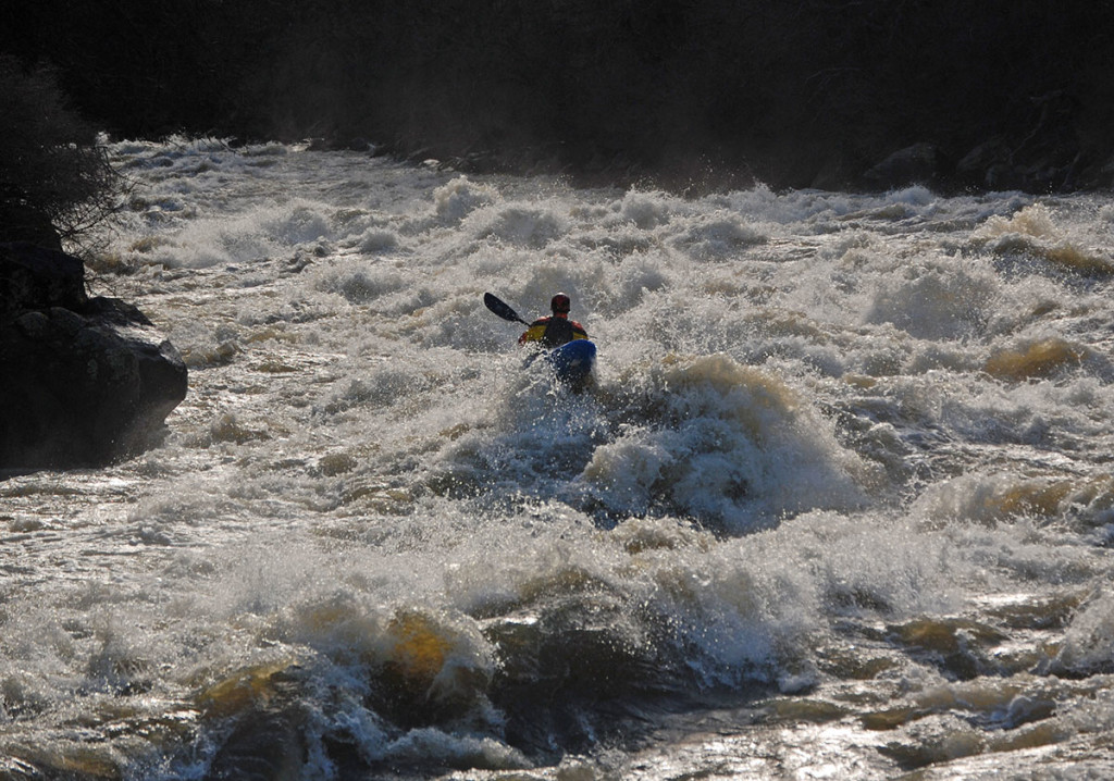
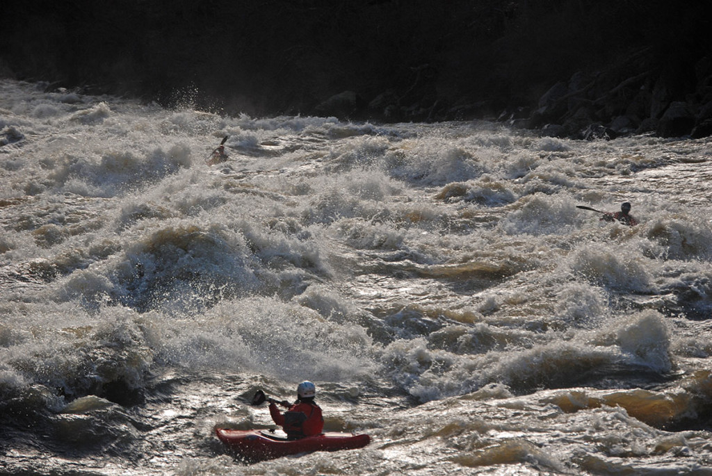
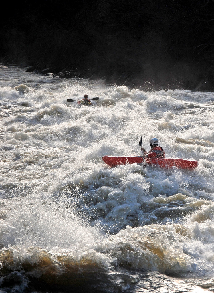
• Green Wall – still the crux of the run. We didn’t scout. In a raft you would. I think there is a cheat down the left but there’s also a gigantic hole formed by the scout rocks. We went right in the entry and right of center in the main rapid. There was a wave that was 20+ feet tall in the middle of the rapid followed by some huge laterals. Your chances of keeping a raft upright where we went would be slim to none and recovery of any kind would be non-existent immediately below Green Wall. The current moves quickly to the pinch below Green Wall, with some reflection waves coming off the left and a room of doom to the left of the pinch.
• Green Wall to Collier Creek – there are large rapids with large waves and places in rapids you would need to move across wave trains. Essentially, Green Wall to Collier Creek would be incredibly difficult in a raft. It’s also really continuous and rescue/recovery would be daunting.
Once you are to Collier Creek you shouldn’t have any problems.
We put in around 10:00 a.m. at McCaleb Ranch and took out at 2:30 p.m. We stopped for 15 minutes at Pine Flat.
Video from Aaron Babcock’s Creature Craft:
For the boatmen, for the thrills, but really just for the rivers
We use cookies on our website to give you the most relevant experience by remembering your preferences and repeat visits. By clicking “Accept All”, you consent to the use of ALL the cookies. However, you may visit "Cookie Settings" to provide a controlled consent.
This website uses cookies to improve your experience while you navigate through the website. Out of these, the cookies that are categorized as necessary are stored on your browser as they are essential for the working of basic functionalities of the website. We also use third-party cookies that help us analyze and understand how you use this website. These cookies will be stored in your browser only with your consent. You also have the option to opt-out of these cookies. But opting out of some of these cookies may affect your browsing experience.
Necessary cookies are absolutely essential for the website to function properly. These cookies ensure basic functionalities and security features of the website, anonymously.
Cookie
Duration
Description
cookielawinfo-checkbox-analytics
11 months
This cookie is set by GDPR Cookie Consent plugin. The cookie is used to store the user consent for the cookies in the category "Analytics".
cookielawinfo-checkbox-functional
11 months
The cookie is set by GDPR cookie consent to record the user consent for the cookies in the category "Functional".
cookielawinfo-checkbox-necessary
11 months
This cookie is set by GDPR Cookie Consent plugin. The cookies is used to store the user consent for the cookies in the category "Necessary".
cookielawinfo-checkbox-others
11 months
This cookie is set by GDPR Cookie Consent plugin. The cookie is used to store the user consent for the cookies in the category "Other.
cookielawinfo-checkbox-performance
11 months
This cookie is set by GDPR Cookie Consent plugin. The cookie is used to store the user consent for the cookies in the category "Performance".
viewed_cookie_policy
11 months
The cookie is set by the GDPR Cookie Consent plugin and is used to store whether or not user has consented to the use of cookies. It does not store any personal data.
Functional cookies help to perform certain functionalities like sharing the content of the website on social media platforms, collect feedbacks, and other third-party features.
Performance cookies are used to understand and analyze the key performance indexes of the website which helps in delivering a better user experience for the visitors.
Analytical cookies are used to understand how visitors interact with the website. These cookies help provide information on metrics the number of visitors, bounce rate, traffic source, etc.
Advertisement cookies are used to provide visitors with relevant ads and marketing campaigns. These cookies track visitors across websites and collect information to provide customized ads.