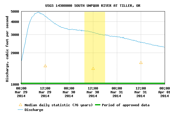
I hadn’t been on the South Umpqua before this trip so I’m not sure what a good flow would normally be. We had 3000 – 3500 at Tiller (it had been raining a fair amount) and that felt to be a medium+ flow. Put in at South Umpqua Falls, which is really a weird, long slide. The river for the most part is flat and class II, but there is the occasional horizon line that got the juices going. The highlight of the trip was Campbell Falls.
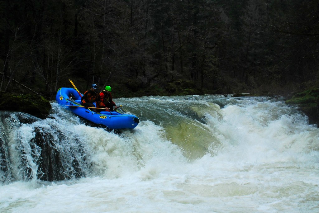
Adam Elson and WIllie Long run the slide at South Umpqua FallsAdam Elson and Willie Long run Campbell Falls on the South Umpqua
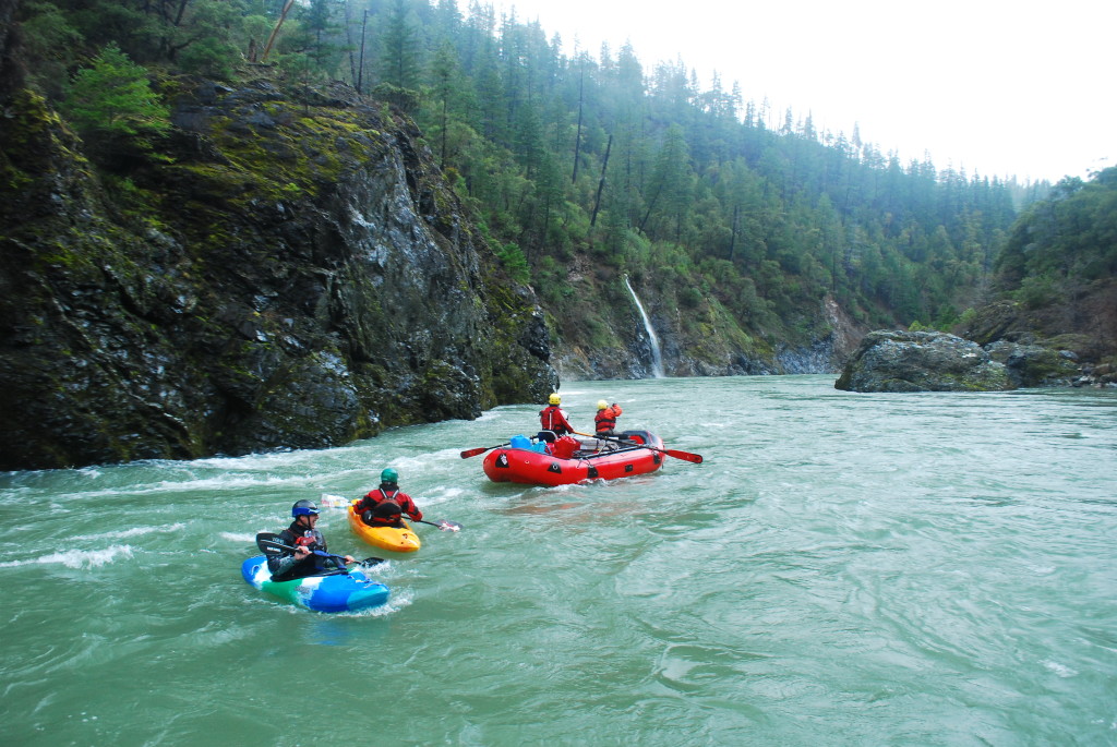
We talked a few Idaho friends (Tony, Andrew, and Josh) into making the trip out, promised it would be worth it… and the water showed up with them. We had great flows for a two-day Illinois trip. Mid-2000s the first day, heavy rain in the afternoon and night, and high flows for the float out on the second day.
Video from the boat:
Video from Green Wall:
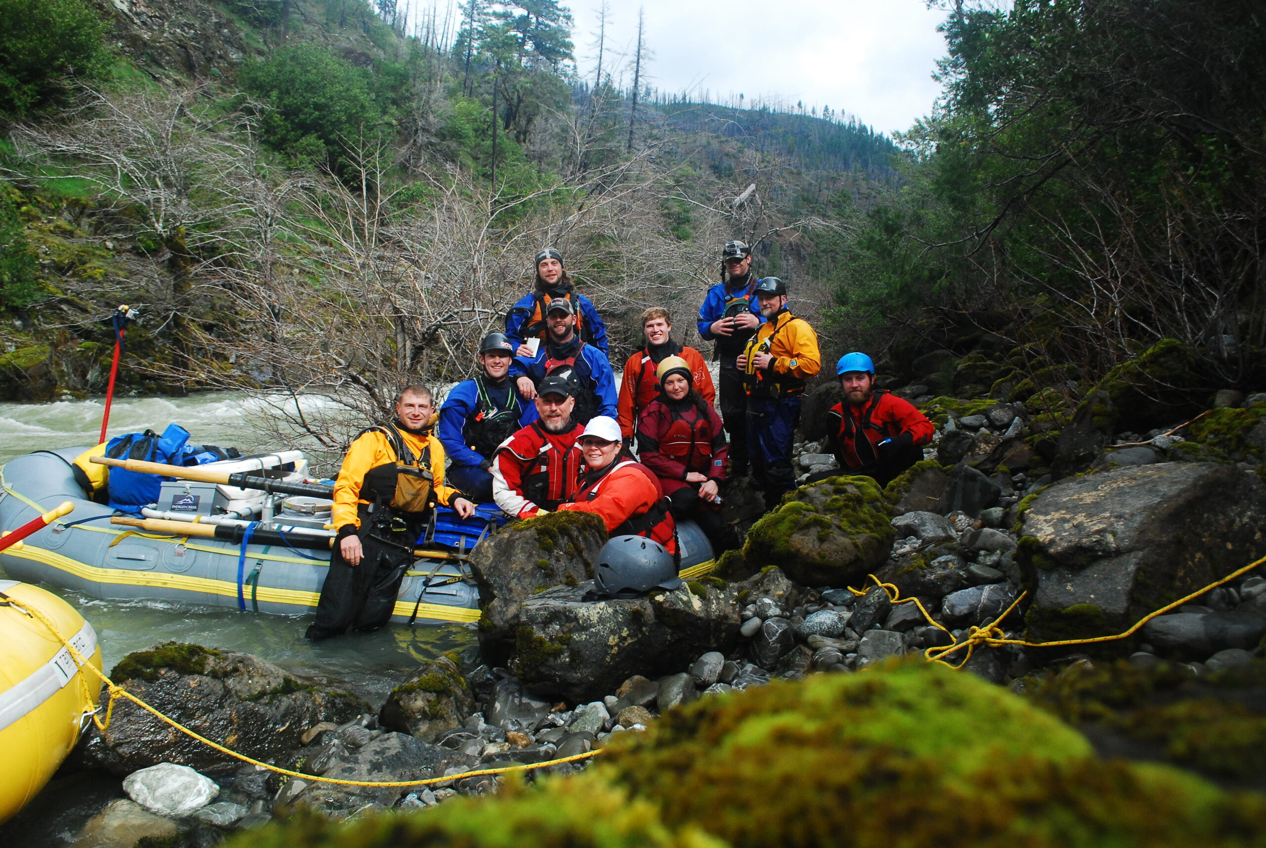
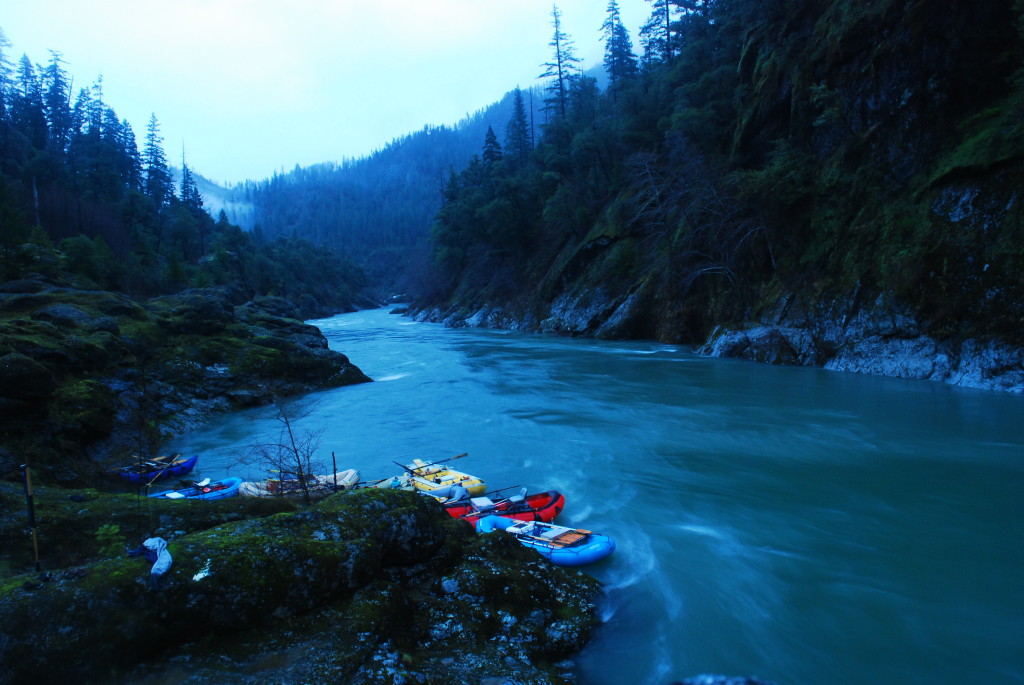
Camp was at Collier Creek, which is an excellent “high water” camp. We stopped at Indigo Creek the next morning and were able to park the boats up the creek because the river was up high. Here are a couple more shots from this trip:
NOTES
This is where I probably had the most difficulty finding accurate and reliable information.
The Chetco Pass route was the shortest and with time being an issue was the most appealing but I found out that they have a POC gate that they keep closed to help with Port Orford Cedar Root Disease. If you start at the gate and hike the road and then drop down it is the same distance as the Babyfoot but it means climbing over a pass. The advantage is you get to hike the first part on the road which seemed appealing since we would be hiking the first miles in the dark. Even though more grueling it would thus eliminate the possibility of getting loss in the dark.
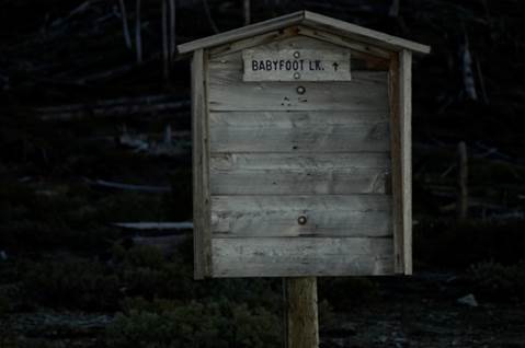
After finding a way to use gps on my iphone. The plans changed to the Babyfoot lake trail and I think for the better. The Babyfoot lake trail also puts you 3 miles up higher and allows you to paddle what they call the “Magic Canyon”.
Driving
To get to the Babyfoot Lake trail head, you take 199 toward Crescent City and right outside of Selma you turn onto $8 Mountain Road. Follow this road to the top of the mountain and then take the left fork. There is a parking lot there with a pit toilet. Very easy to find and everything is well marked.
NOTES
We were not sure if 4×4 would be needed or a vehicle with ground clearance, etc. but this is a gravel road, you could take a Mercedes up. I also was warned that it would be completely snowed in
Hiking
Distance – 9 miles
The hike into the Chetco
We arrived at the trail head on Friday after work and began hiking at 7pm. We hiked till 11:30 pm and crashed. The temperature was cool and perfect for hiking. That night it started to drizzle/rain. We just pulled out the tarps and rolled up in them like tacos till morning. By morning the rain had stopped, we ate breakfast and started hiking around 8am. We reached the put-in at about noon on Saturday.
NOTES
Hiking with a kayak is difficult. A kayak alone ways 50 lbs then put about 25 lbs gear in it and you are at 75 lbs, not only that but it is large and awkward. These miles are also on trails with loose rocks, limbs and downed trees.
River
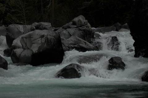
The put-in looked low and scrappy. It soon picked up volume. The upper section is tight and technical.
The Upper Chetco – low and scrappy at the start
We were able to boat scout and run everything thus moving quicker than I thought we would. We put on about 1pm and paddled till dark and was only about 2 miles from Tolman Ranch having covered about 20 miles.
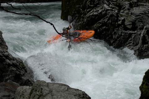
It rained all night and our shuttle was not going to pick us up till 5pm so it would be lots of waiting around in the rain so we decided to get an early start and push on thus getting the lower Chetco which has Candy Cane rapid and Cone Head, two solid class Vs.
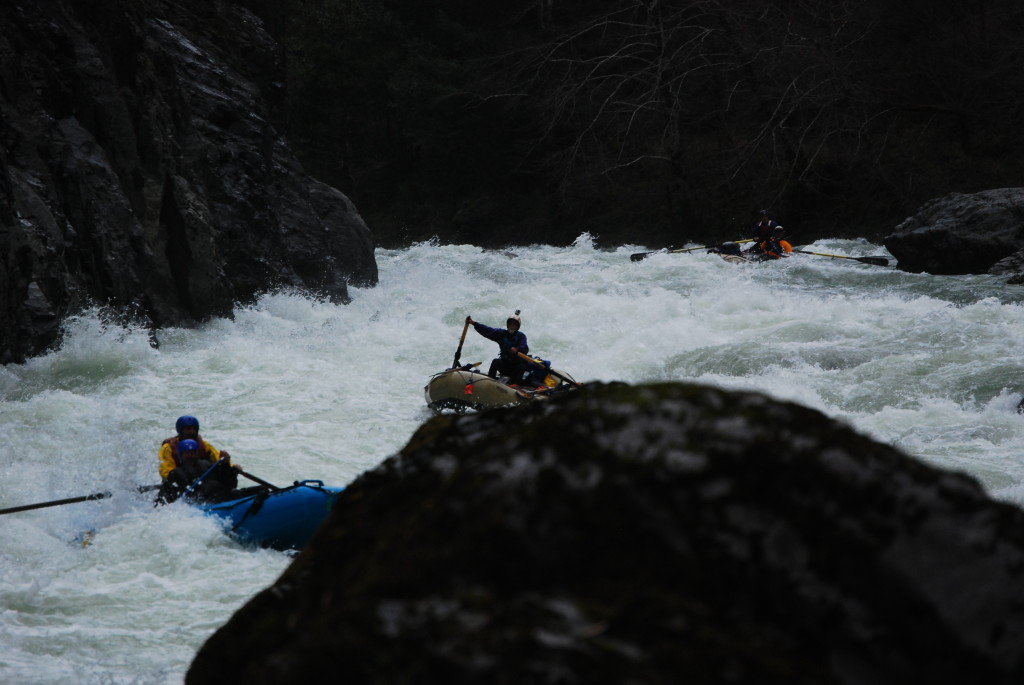
Running Conehead Rapid on the Chetco River
We were able to get a text out at the second bridge to our driver with the change of plans to meet us at the start park. We arrived there at 3pm and was back to Grants Pass after picking up our put-in vehicle by 7pm.
Gauge
We had a consistent 1800 on the Chetco gauge near Brookings. This is adequate water but if I were to do it again. I think idea would be 3000 and dropping on the Gauge thus cleaning up a lot of mank in the early sections.
Take-out
Our initial plans were to take out at the first bridge crossing the Chetco. Some reports said bring a rope to get your gear up. Don’t be fooled there is an easy trail after the bridge on river right. We ended up taking out at Alfred Leob state park. Ideal takeout would be the South Fork Chetco confluence on River Left. Thus getting the two Class Vs and cutting out the flat water.
Conclusion
It was neat to see and feel how this river starts out as a mountain stream and then gains volume and turn into a river. The vegetation also drastically changes from dry and airy to moss covered and coastal. The rapids are well spaced and I never lost boredom with flat water until below the Sourth Fork junction. The lower rapids had lots of big rocks and different lines and were quite fun.
After 9 miles hiking with a kayak and 40 river miles, I could not wait for a hot shower with a cold beer!
For the boatmen, for the thrills, but really just for the rivers
We use cookies on our website to give you the most relevant experience by remembering your preferences and repeat visits. By clicking “Accept All”, you consent to the use of ALL the cookies. However, you may visit "Cookie Settings" to provide a controlled consent.
This website uses cookies to improve your experience while you navigate through the website. Out of these, the cookies that are categorized as necessary are stored on your browser as they are essential for the working of basic functionalities of the website. We also use third-party cookies that help us analyze and understand how you use this website. These cookies will be stored in your browser only with your consent. You also have the option to opt-out of these cookies. But opting out of some of these cookies may affect your browsing experience.
Necessary cookies are absolutely essential for the website to function properly. These cookies ensure basic functionalities and security features of the website, anonymously.
Cookie
Duration
Description
cookielawinfo-checkbox-analytics
11 months
This cookie is set by GDPR Cookie Consent plugin. The cookie is used to store the user consent for the cookies in the category "Analytics".
cookielawinfo-checkbox-functional
11 months
The cookie is set by GDPR cookie consent to record the user consent for the cookies in the category "Functional".
cookielawinfo-checkbox-necessary
11 months
This cookie is set by GDPR Cookie Consent plugin. The cookies is used to store the user consent for the cookies in the category "Necessary".
cookielawinfo-checkbox-others
11 months
This cookie is set by GDPR Cookie Consent plugin. The cookie is used to store the user consent for the cookies in the category "Other.
cookielawinfo-checkbox-performance
11 months
This cookie is set by GDPR Cookie Consent plugin. The cookie is used to store the user consent for the cookies in the category "Performance".
viewed_cookie_policy
11 months
The cookie is set by the GDPR Cookie Consent plugin and is used to store whether or not user has consented to the use of cookies. It does not store any personal data.
Functional cookies help to perform certain functionalities like sharing the content of the website on social media platforms, collect feedbacks, and other third-party features.
Performance cookies are used to understand and analyze the key performance indexes of the website which helps in delivering a better user experience for the visitors.
Analytical cookies are used to understand how visitors interact with the website. These cookies help provide information on metrics the number of visitors, bounce rate, traffic source, etc.
Advertisement cookies are used to provide visitors with relevant ads and marketing campaigns. These cookies track visitors across websites and collect information to provide customized ads.