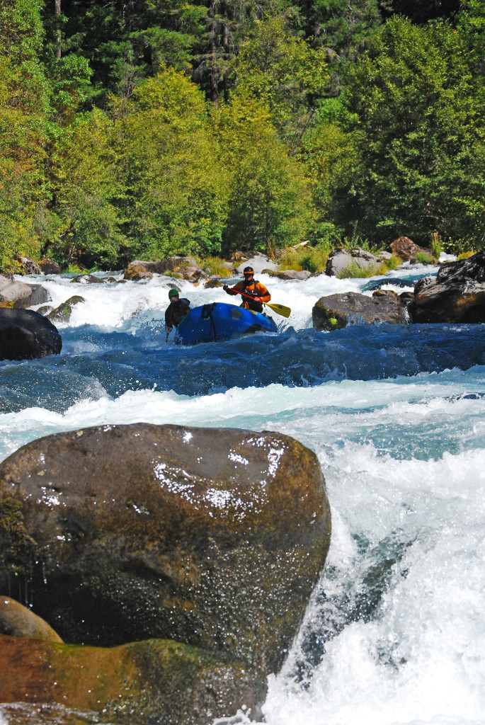
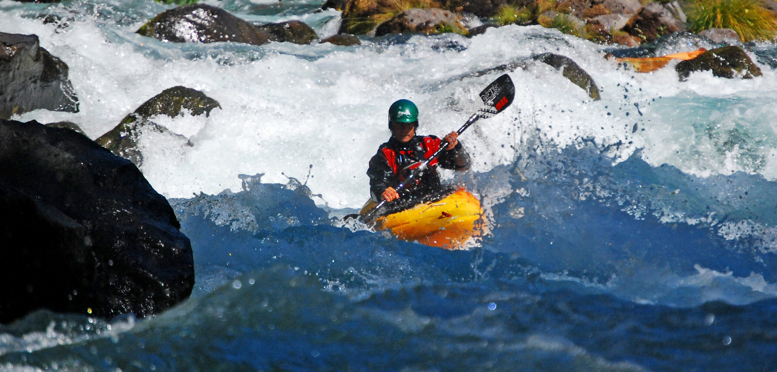
Despite low flows, the MF Smith Oregon Hole Gorge and the SF Smith gorge were “good to go kind of.” One portage on the South Fork, but other than that we successfully slammed into rocks and scraped our way downstream.
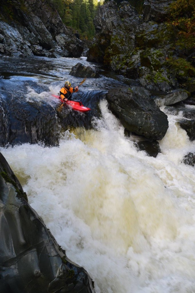
Despite low flows, the MF Smith Oregon Hole Gorge and the SF Smith gorge were “good to go kind of.” One portage on the South Fork, but other than that we successfully slammed into rocks and scraped our way downstream.
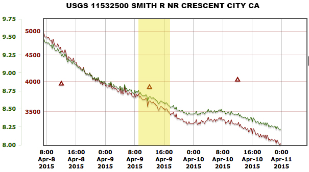
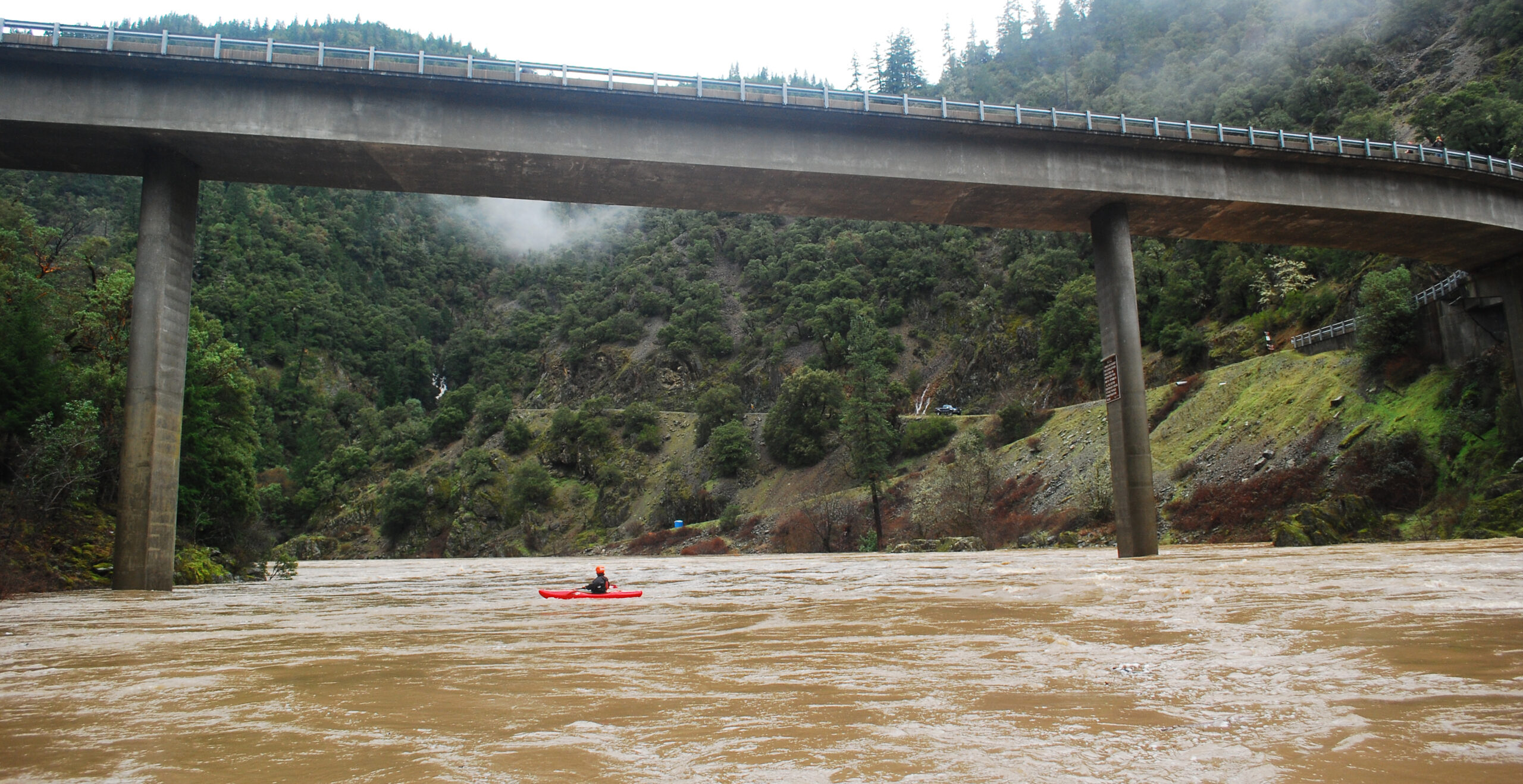
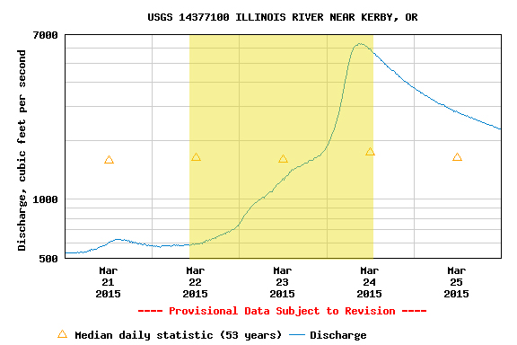
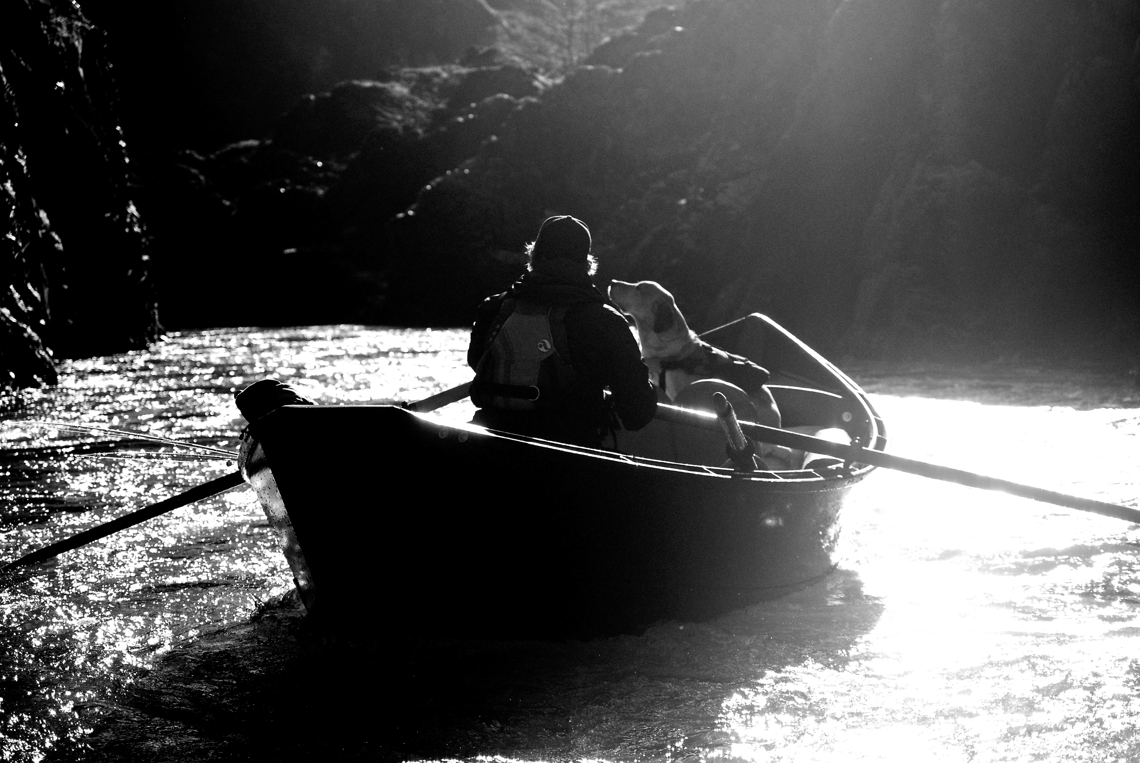
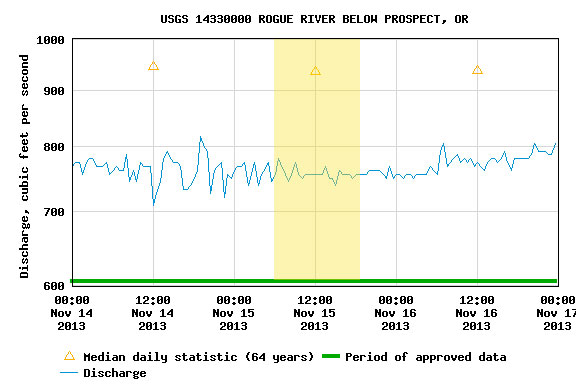
Zach Urness had been bugging me about getting back on the North Fork of the Smith. We had low flows but beautiful weather. The gauge above shows flows at Jed Smith, which are reported in CFS and Feet. This is a different gauge than the one Bearfoot Brad reports (which is at the actual confluence of the NF and MF Smiths) but the one above is the official USGS gauge. The gauge at the mouth of the NF is a foot gauge that is meant to correlate with the USGS gauge at Jed Smith. However, isolated weather events can throw this correlation off, in which case it’s best to use Brad’s gauge.
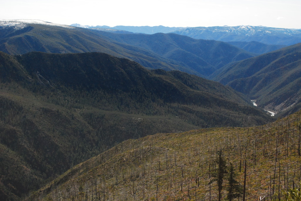
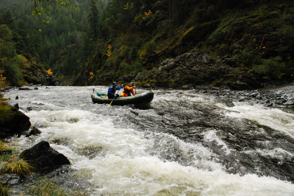
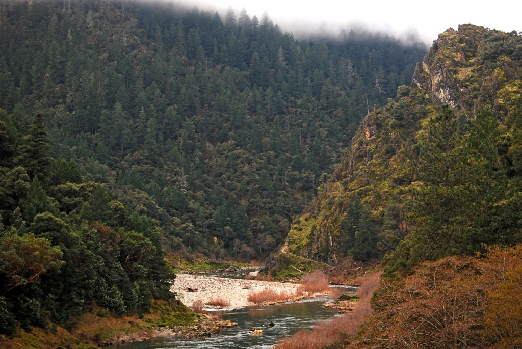
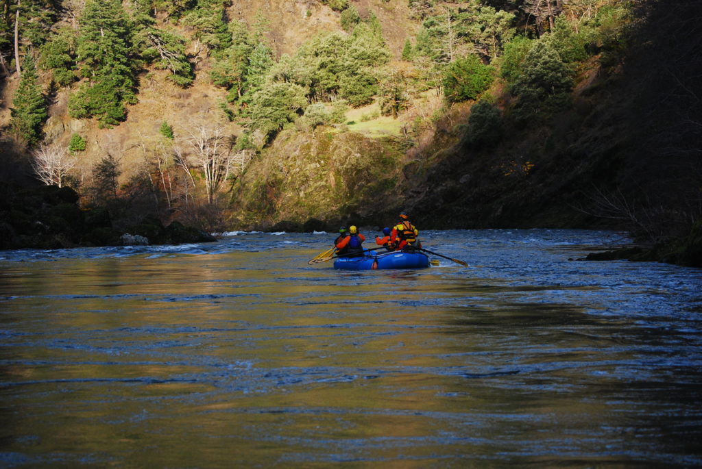
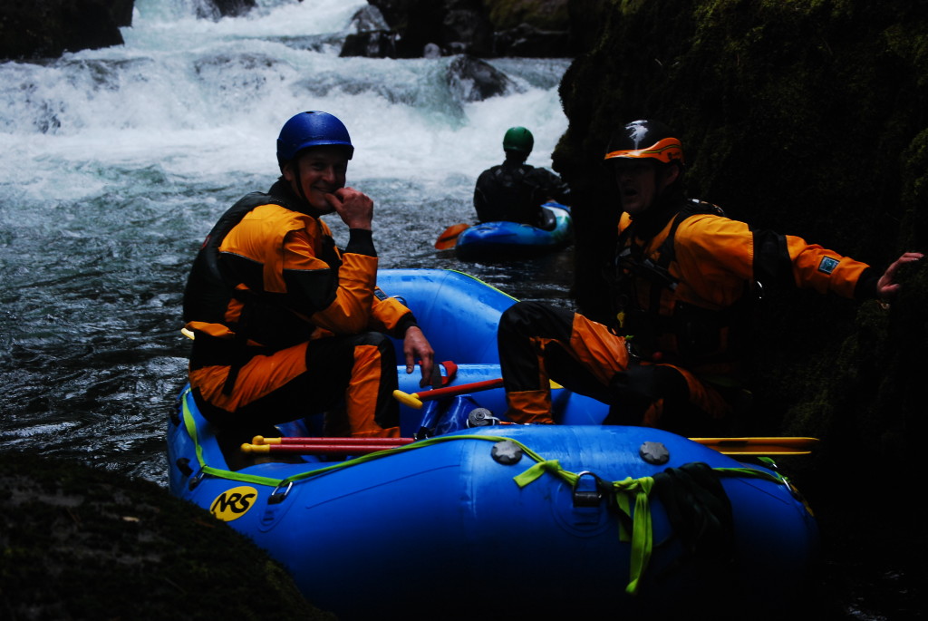
Three days on the Illinois is hard to beat. Three of us met in Selma and headed to the river. The water was a bit low the first day but the rain started coming down and by day two we were floating on a healthy flow. Our first night we camped at Klondike Creek and on night two we stayed at Waterfall.
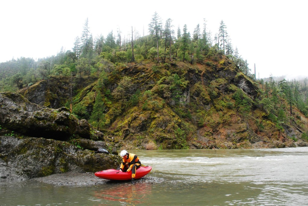

On Saturday, February 7th, three of us pushed off from Almeda on the Rogue River and headed downstream. Four and a half hours later we were at Foster Bar. Here’s what I remember. Thank you to Roger Goth, Aaron Stone, and Erik Weiseth for providing great beta before we pushed off. There are some incredible stories of folks doing this kind of trip back in the day. We were fortunate enough to bring home some photos and video. We weren’t the first, this was not a speed record, but it was an incredible experience.
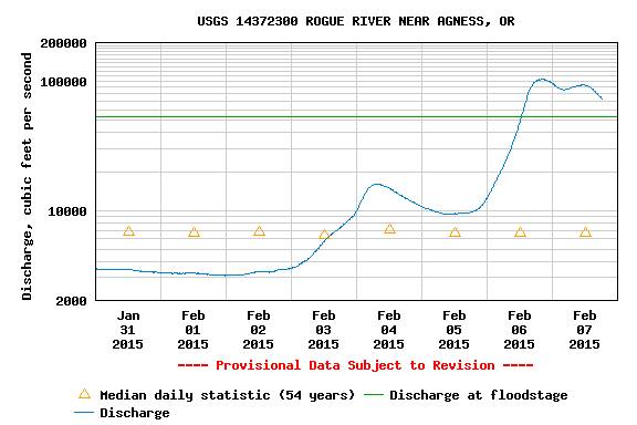
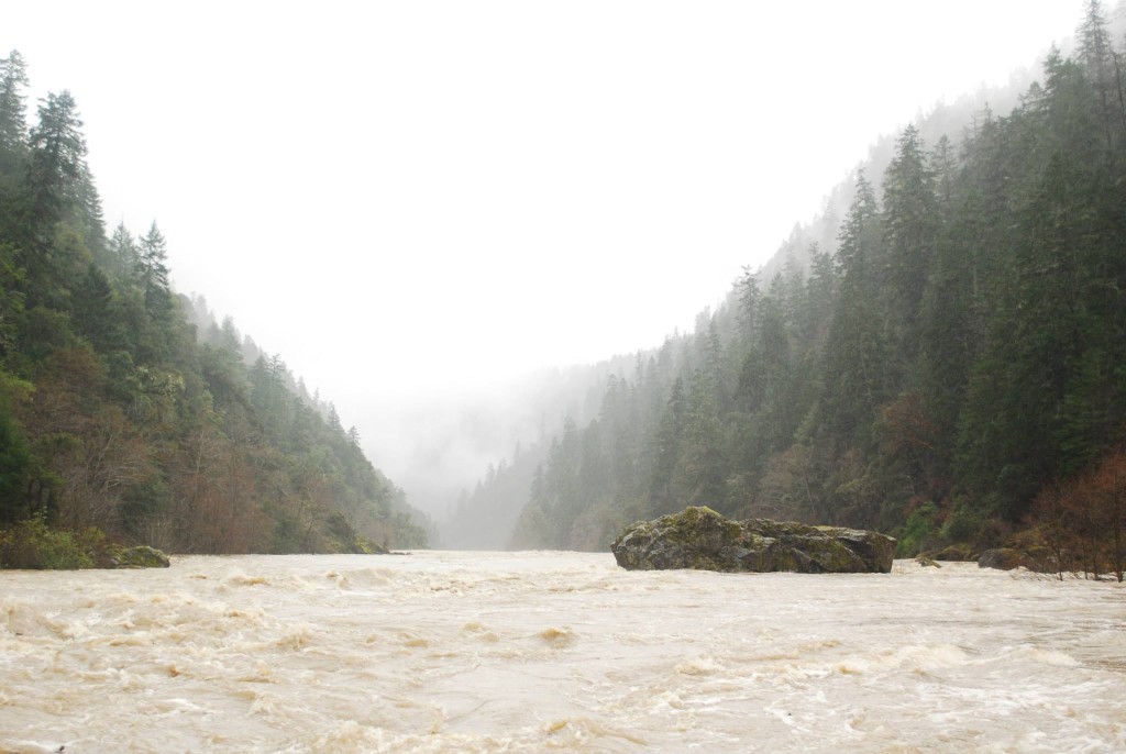
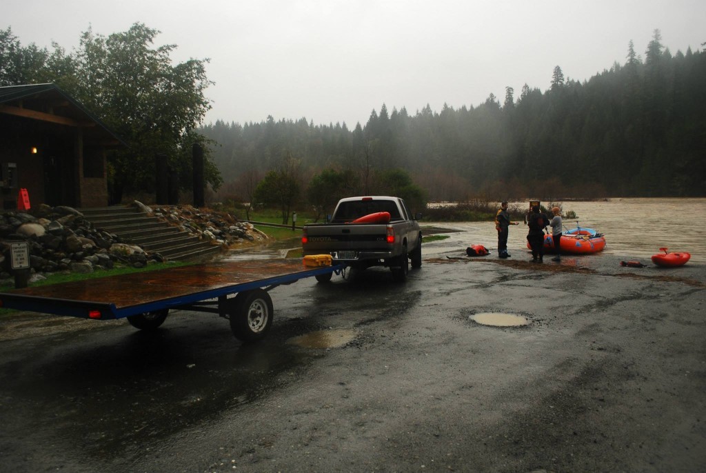
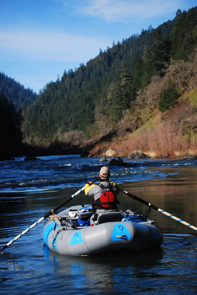
On Friday I was contacted by Aaron Lieberman of Orange Torpedo Trips. He wanted to run the Rogue the following day. He told me I could just show up – no boat needed. I was mainly interested in photographing the river at such a high flow, so it sounded perfect. It peaked at 104,000 c.f.s. in Agness Friday night. I met him at the OTT warehouse in Merlin at 8:00 a.m. Jeanne Fields drove our shuttle. We left OTT around 9 a.m. It was me and Aaron in a raft and Hunter Connolly in a kayak. We pushed off from Almeda at 9:45 a.m.
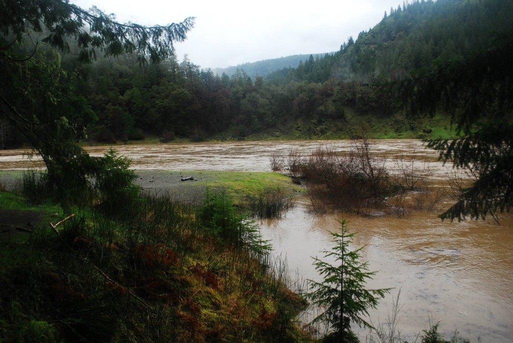
The river was fast and had some scary looking eddies, but it was pretty flat between Almeda and Quail Creek. On the way we stopped at Horseshoe Bend. The water was lapping at the top of the bar. We joked that from now on, we will only camp at Horseshoe at 90k+ CFS because the carry is way easier. The water was so high complete river bends were gone, which made it somewhat difficult to figure out where we were in a few places. There was no indication of Rainie Falls, Upper and Lower Black Bar were literally non existent (no waves or anything), and Sports Illustrated Rock (in the Battle Bar Flats) was sticking out maybe 10 feet. The larger waves and features that we saw seemed to be in places where, at normal flows, there are no rapids. Places that normally have rapids were pretty flat.
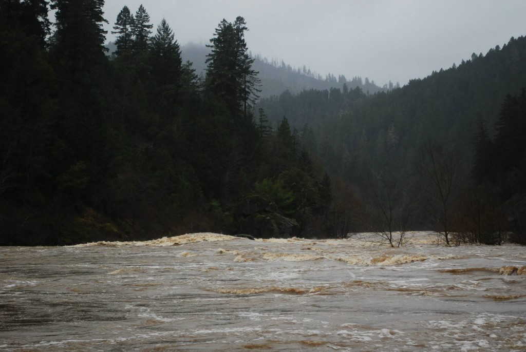
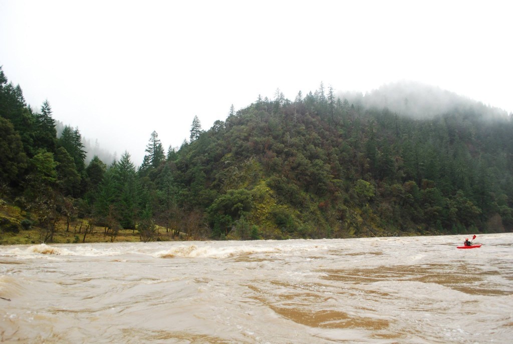
Despite there being very few actual rapids, the rowing was exhausting (mainly to avoid eddy lines and to correct for the unpredictable waves and current) so we switched on and off on the oars. Aaron was rowing when we got to Boulder Ally (there are varying names here, also known as “Elephant Rock”) and the character of the river changed. It went from a relatively calm river to one that felt like it was really flooding. It was a lot pushier. I guess that could be attributed to 1) We probably started on 30,000ish and as we moved downstream volume increased to nearly 90,000 and 2) Maybe the river becomes more constricted in the lower half?
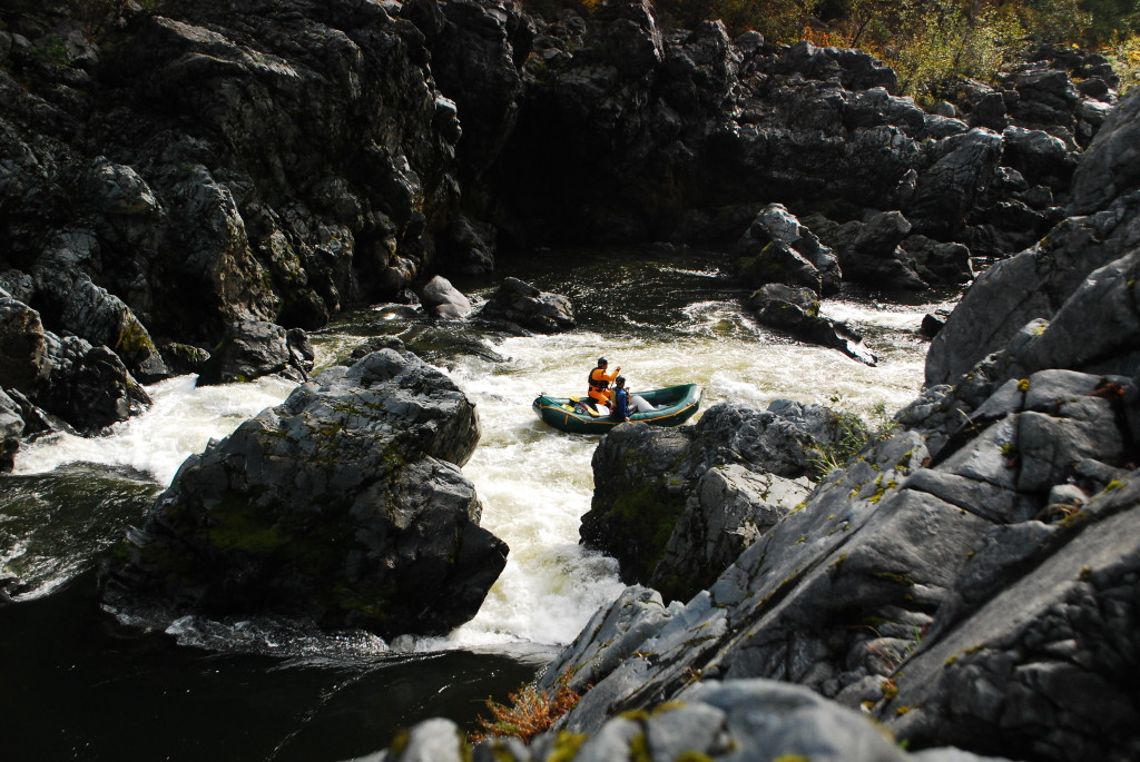
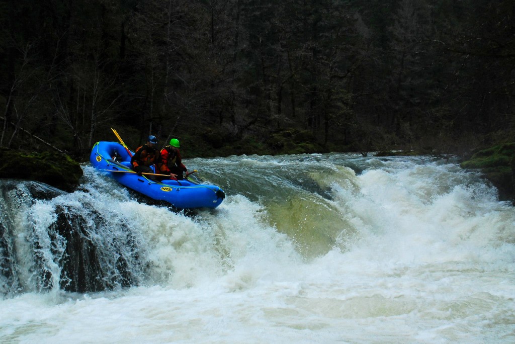
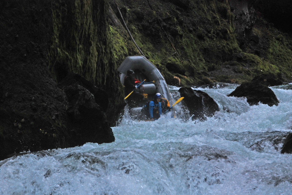
Towards the bottom of Boulder Ally we got pushed to an outside bend and Aaron had to make an incredible hero pull back to the inside to avoid some nastiness. That pull zapped him pretty well, so I jumped on the oars and we were soon taking a quick break at the mouth of Mule Creek. We decided that I would run Mule Creek Canyon and then we would pull over to look at Blossom and Aaron would run Blossom. From what we had heard, Mule Creek Canyon would be under water and the mouth of Stair Creek would have boils. Well, Mule Creek Canyon was under water but the rapid just upstream of the mouth of Stair Creek was huge. We could see some exploding waves and a giant giant giant set of boils on the left. There was a nasty eddy on the right, a huge eddy on the left, and what looked like a thin line of current (moving at about a million miles an hour) in between the two just right of center. I missed to the right and we went for a wild ride on the eddy line on the right. For a split second, a whirl pool grabbed the nose of the boat and I thought we were turning over end-over-end downstream. Here’s a video:
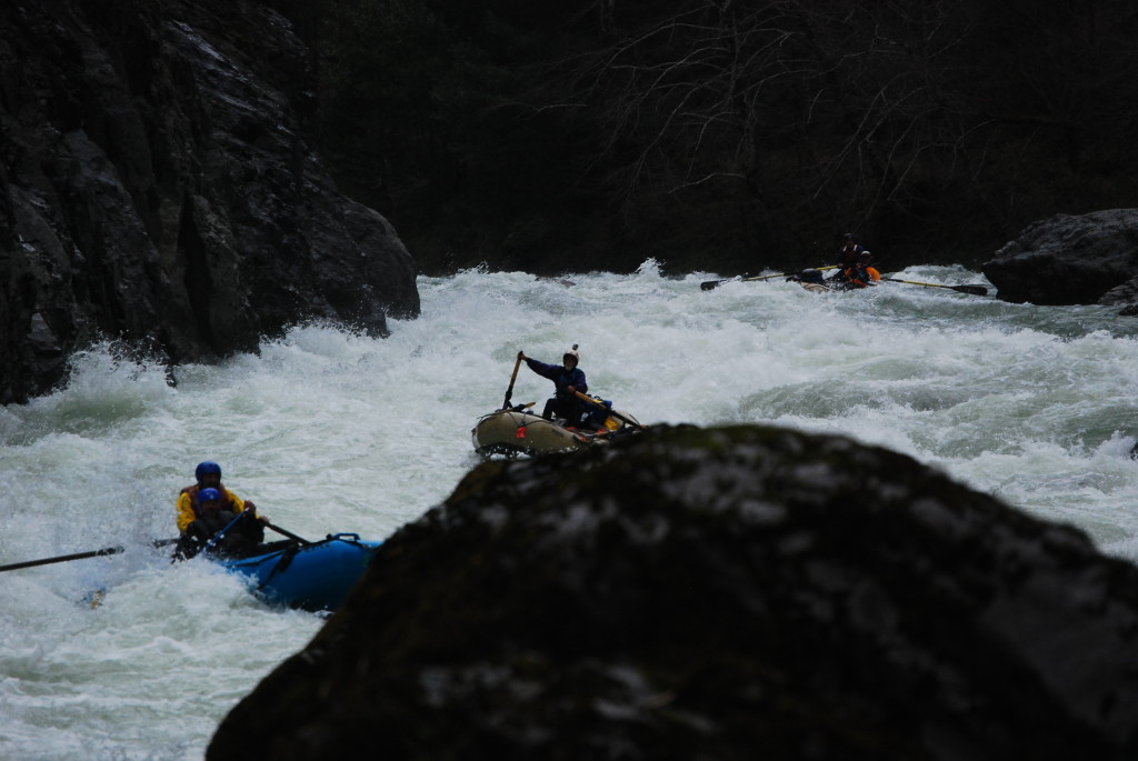
The current grabbed the back of the boat and we were yanked back into the downstream flow. Now things were interesting. The worst eddies we’d seen all day were between Mule Creek Canyon and Blossom. The normal scout for Blossom is on river right. All day long we were trying our best to stick to the inside. We were flying downstream and a left hand bend showed an eddy on the outside. Starting inside, we began the move to the outside and tried breaking through the wave train. It quickly became apparent that catching the eddy probably wasn’t going to happen and if we tried much more and missed we’d be stuck on the outside bend going into Blossom with no idea of what lay ahead. So, a quick change of plans had us pulling back left and missing the giant erratic waves that strung from the right to the center of the river. Stayed left and towards the bottom had to time the move back right to avoid a gnarly swirling eddy that a lot of the current was pushing into.
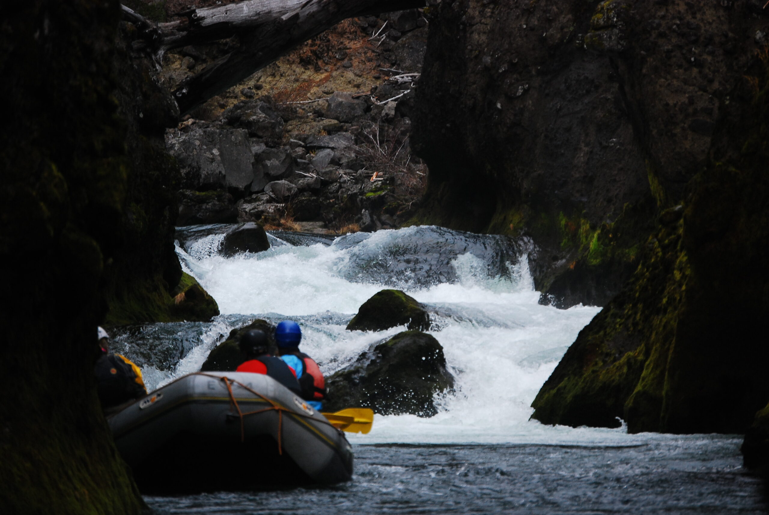
Stair Creek, Mule Creek Canyon:
Blossom Bar:
Catching take-out at Foster was maybe the most difficult pull of the whole trip because the water was nearly to the toilet but the river right channel was filled with trees. We had to swing way outside initially but Aaron made another great pull and we were soon resting at Foster Bar. Our shuttle arrived 3 minutes later (they had taken the coast route). 4.5 hours from start to finish. I was back in Ashland by 6:00 p.m.
So that’s the story. Probably wouldn’t do it again, but then again………
Mike Dearing picked me up in Ashland and rowed me down the river. Aaron Lieberman and Roger Goth met us at Tyee on night one and then we camped at Upper Tacoma on night two. As if to hammer home the fact that Southern Oregon has missed out on winter, we took Bear Camp back and did not see a speck of snow. Bummer, but also nice to shorten the normal winter shuttle.
We did get some rain but it wasn’t a real winter storm. The Rogue is beautiful in the winter, but I miss the ice.
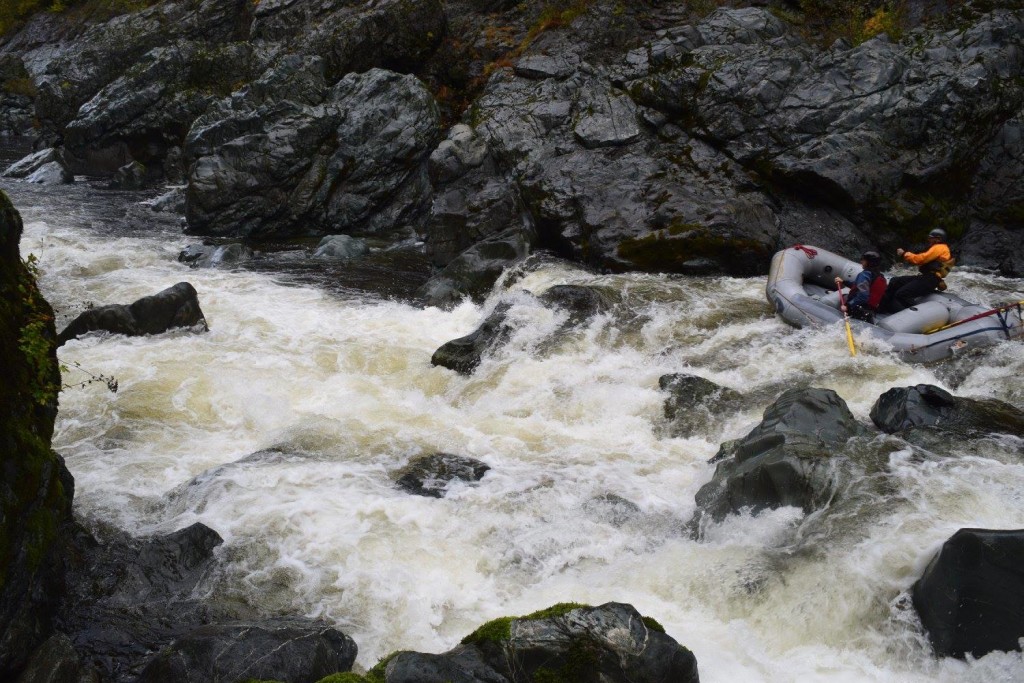
This was supposed to be a two-day Illinois trip, but on Friday night it dumped rain and the water shot up and over 6,000 cfs. We woke up in the morning and decided to run the Green Bridge stretch of the Illinois to Six Mile Access. The miles went by quickly and soon we were back in Selma waiting for Sunday to arrive. The water dropped through the night and in the morning it was falling below 3,000 cfs. Launched from Miami Bar and we got to Oak Flat take out just before dark and then took Bear Camp back over. All in all a tiring trip but worthwhile!

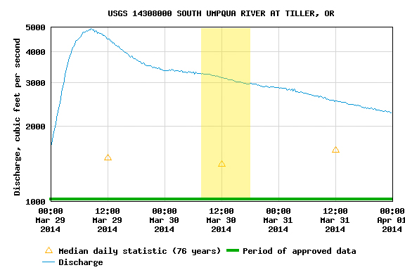
I hadn’t been on the South Umpqua before this trip so I’m not sure what a good flow would normally be. We had 3000 – 3500 at Tiller (it had been raining a fair amount) and that felt to be a medium+ flow. Put in at South Umpqua Falls, which is really a weird, long slide. The river for the most part is flat and class II, but there is the occasional horizon line that got the juices going. The highlight of the trip was Campbell Falls.


We talked a few Idaho friends (Tony, Andrew, and Josh) into making the trip out, promised it would be worth it… and the water showed up with them. We had great flows for a two-day Illinois trip. Mid-2000s the first day, heavy rain in the afternoon and night, and high flows for the float out on the second day.
Video from the boat:
Video from Green Wall:
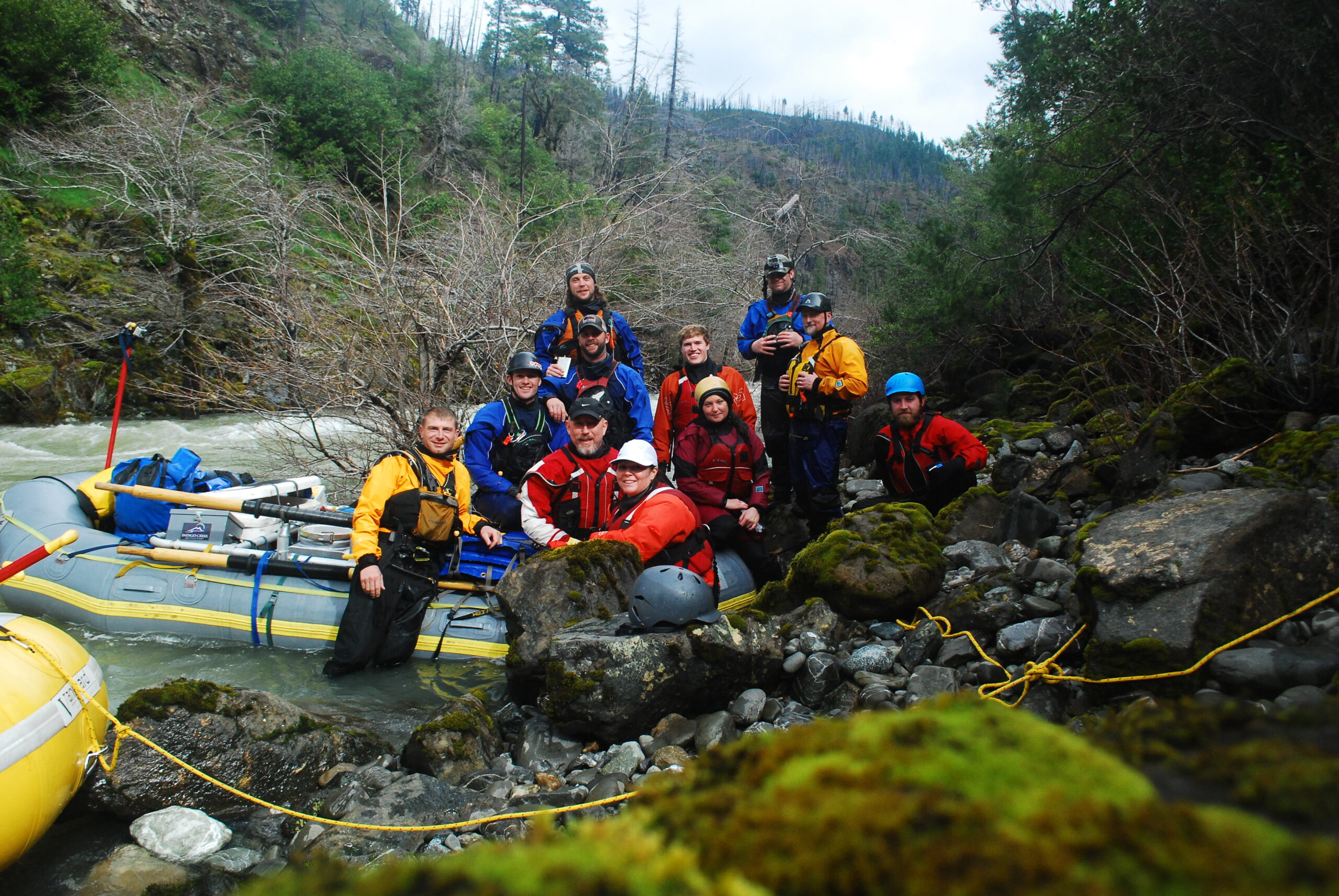
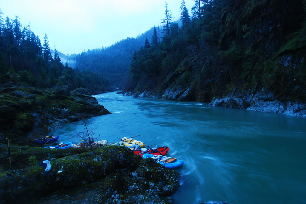
Camp was at Collier Creek, which is an excellent “high water” camp. We stopped at Indigo Creek the next morning and were able to park the boats up the creek because the river was up high. Here are a couple more shots from this trip:
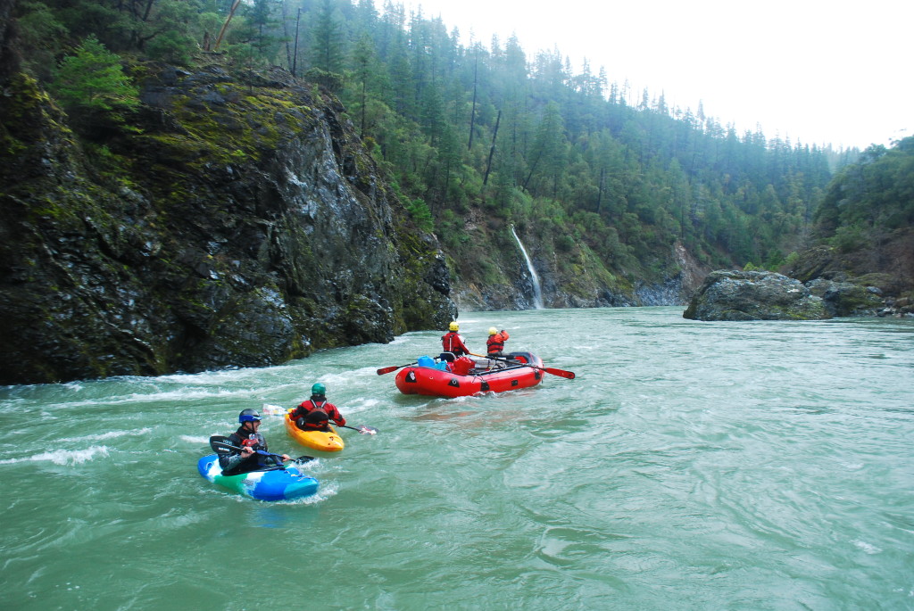
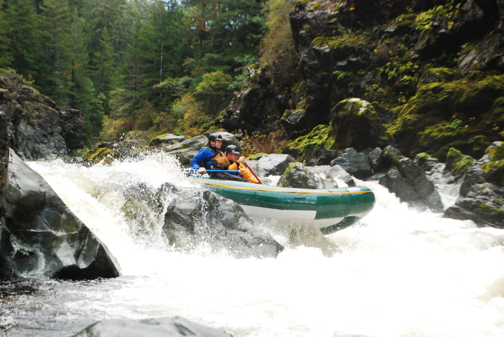
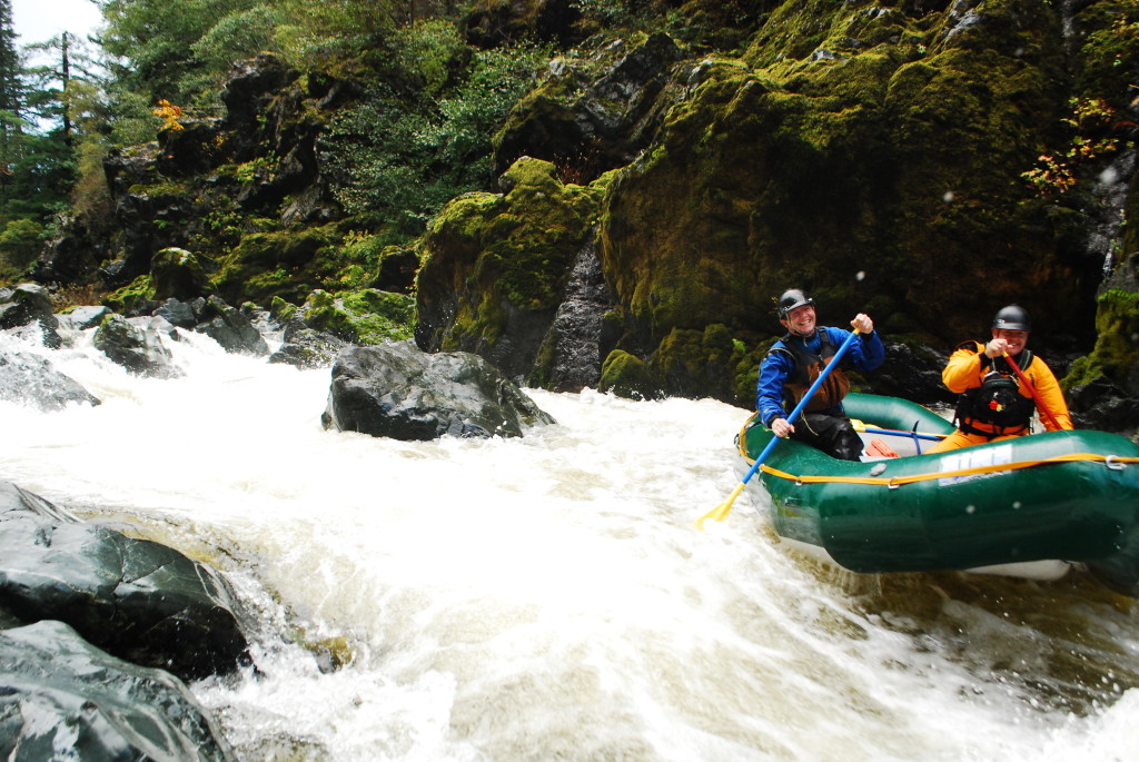
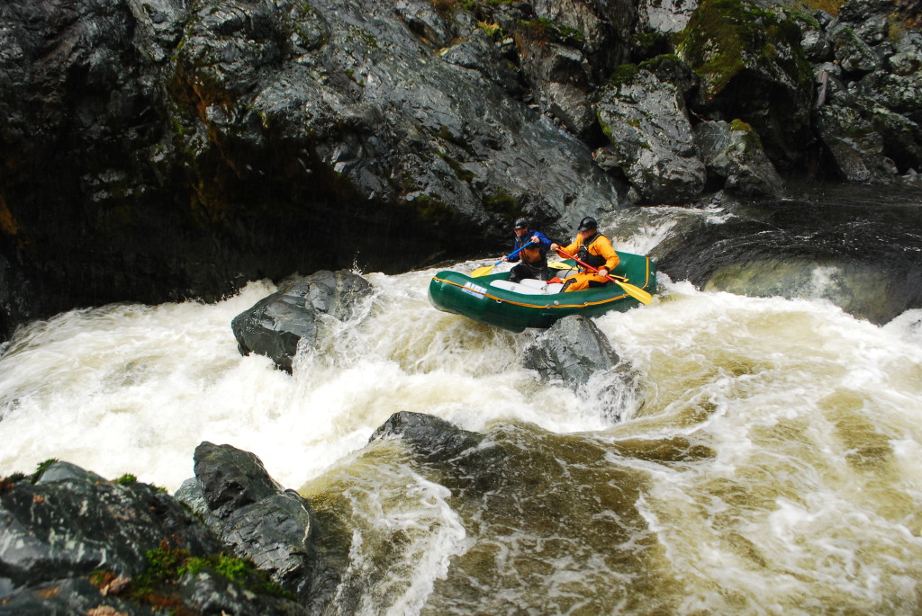
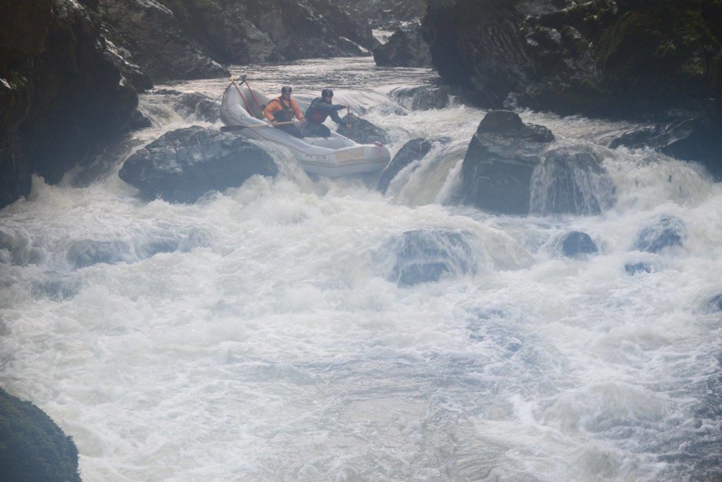
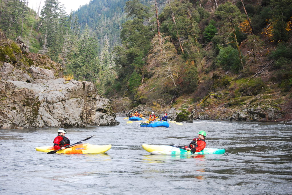
On this trip we had five rafts. Flow was low. I think you take the above gauge and divide in half for actual flow. If someone knows better please let me know in the comment section below. The crux at this flow was the second drop of the the first rapid (after entry rapid and sharp right turn). You can go left or right. Boats that tried to go right got spanked a bit. Boats that went left did alright. At this flow, it is tough to have a “clean” line in there with a raft because it is so tight.
R2 – Erik Sol and Michael McKenzie
R2 – Aaron Babcock and Thomas Hood
R2 – Glen Finch and Jeff Finch
R3 – Skip Volpert, Mike and McCale
R4 – Will Volpert, Steve, Adam Spencer, John Bartosz

The Mill Creek stretch of the North Fork of the Rogue River is a spectacular stretch of water. It is a short run, however, and so on this particular day we did two laps. If you catch this stretch during a recreational release there is a shuttle vehicle organized by the power company, which is a nice plus.
In a raft, this is a pretty technical run but a ton of fun. Here’s a video of our second run (TJ Vandehey and Will Volpert):